Esta tradução é mais antiga do que a página original e poderá estar desatualizada. Veja o que foi alterado.
Traduções para esta página?:
Esta é uma versão antiga do documento!
 This page is not fully translated, yet. Please help completing the translation.
(remove this paragraph once the translation is finished)
Esta página descreve alguns princípios básicos do Geocaching e como utilizar o c:geo para encontrar Geocaches.
Explicar todo sobre o Geocaching seria um pouco demais para este guia. Mas há alguns factos que tem de conhecer antes de começar a fazer Geocaching com o c:geo:
É importante aprender os diferentes tipos de caches, classificações de D (Dificuldade)/T (Terreno), atributos, etc.
É possível que não consiga encontrar uma cache se apenas selecionar uma aleatória no c:geo e navegar até à mesma. À muitos mais detalhes que precisará de conhecer antes de escolher a cache que mais se adequa à sua procura.
A maioria da plataformas de Geocaching que o c:geo suporta oferecem guias detalhados sobre como funciona o Geocaching. Recomendamos que leia estes guias para aprender tudo o que precisa para encontrar a sua primeira geocache e como registar a visita.
Deve ter especialmente atenção ao tipo de geocache (Normalmente uma cache do tipo “mistério” não está nas coordenadas publicadas) e à classificação T (uma cache T5 significa que normalmente será preciso escalar, nadar ou mergulhar para chegar à cache).
Como qualquer atividade ao ar livre o Geocaching pode ser perigoso. Nem o c:geo, nem qualquer uma das plataformas de Geocaching se responsabilizam pelas suas atividades. Tenha atenção e precaução em relação ao que está a fazer, como faria com qualquer outra atividade ao ar livre
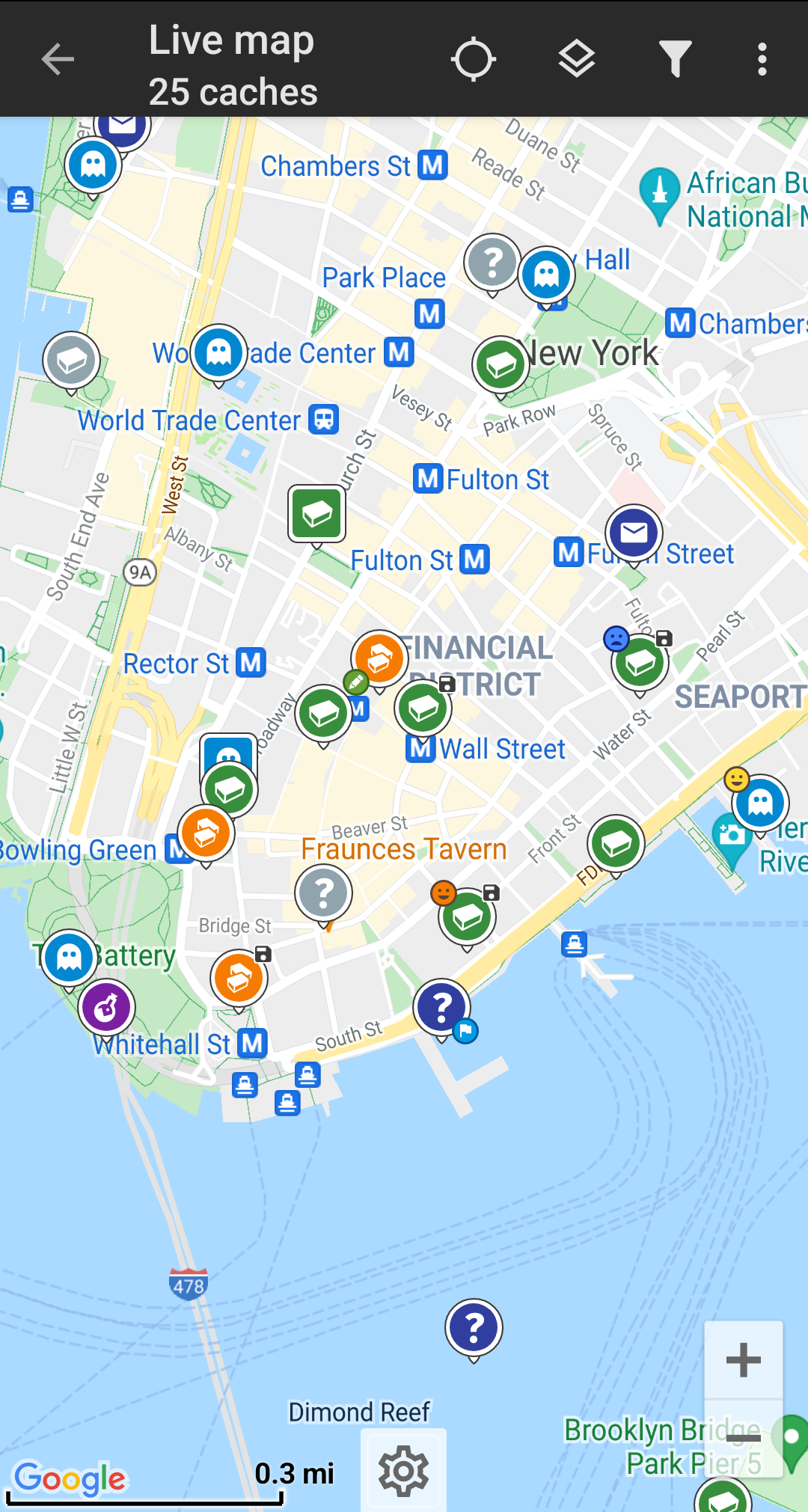
From c:geo main menu use the Live Map  or the
 Nearby  menus of c:geo to see which caches are around you.
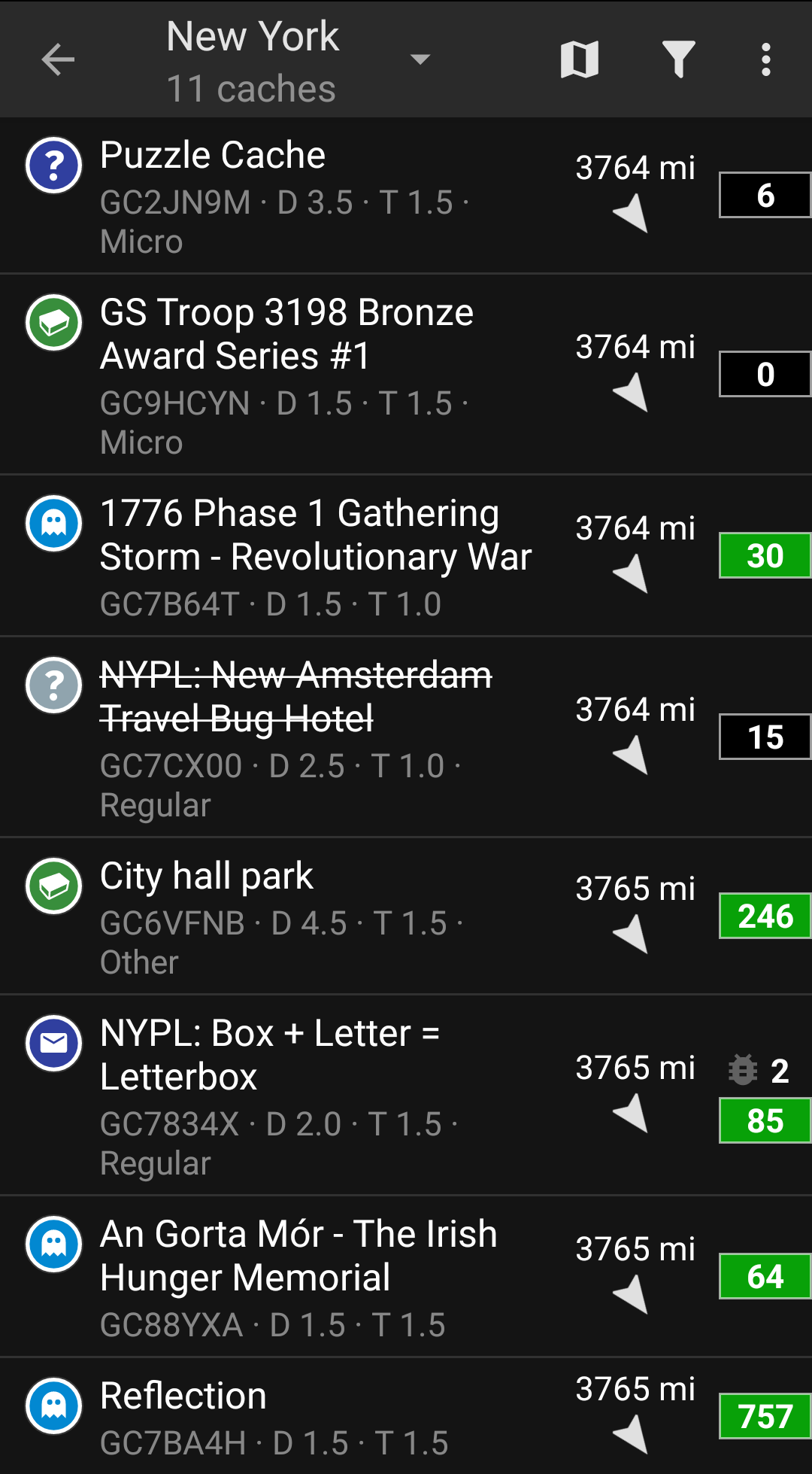
After you managed to see caches on the map or in the nearby list, pick a cache you would like to find (a traditional cache with a low D/T rating will be a good starting point) and open its details.
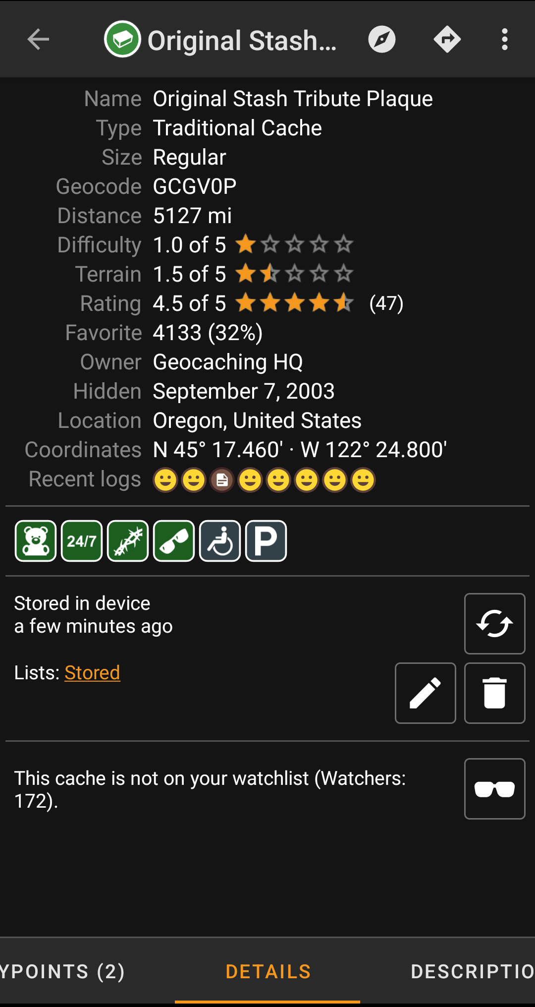
Once you opened a cache listing you can swipe left and right to access more information about the cache (e.g. cache description, additional waypoints, log history,etc.). Read the listing text and pay attention to the D/T-ratings and attributes to learn more about how to find and log this cache.
Once again:
You should make yourself familiar with the different types, terrain ratings, attributes, etc. before starting out to find a cache!
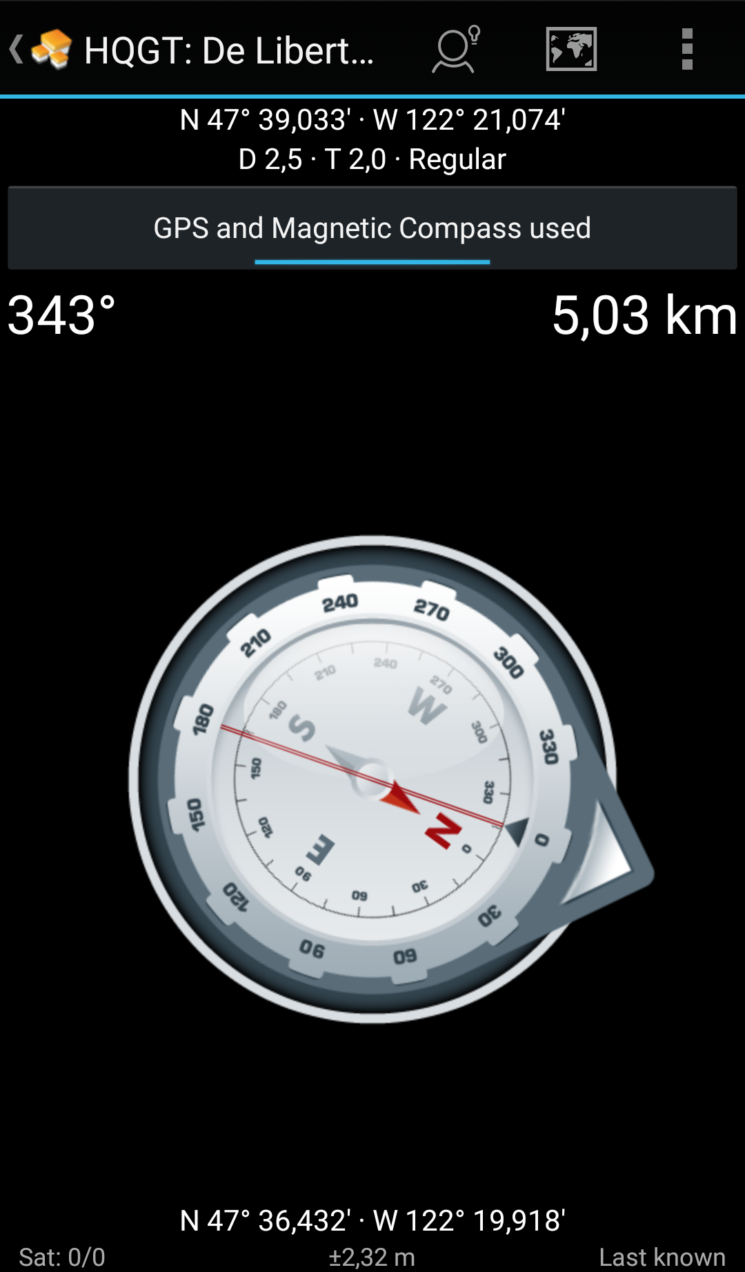
If you finally selected a cache and are good to go, press the Navigate icon  in the title bar of the cache details. You will have several options depending on your needs. Here is a brief description of the most important navigation methods:
This is only a brief introduction of the functionalities in c:geo. To learn more about c:geo functions and menus, you should continue reading the c:geo User Guide.
