Cette traduction est plus ancienne que la page originale et est peut-être dépassée. Voir ce qui a changé.
Traductions de cette page?:
Ceci est une ancienne révision du document !
 Cette page n'est pas encore traduite entièrement. Merci de terminer la traduction
(supprimez ce paragraphe une fois la traduction terminée)
c:geo supporte les carte vectorielles hors-ligne Openstreetmap utilisant le format mapsforge.
L'utilisation d'une carte hors ligne avec c:geo en combinaison avec des caches stockés vous permet d'utiliser c:geo complètement hors ligne (par exemple, lorsque vous ne voulez ou ne pouvez pas utiliser une connexion avec les données mobiles).
Outre les fichiers de cartes hors ligne, c:geo prend également en charge les thèmes de cartes connexes. En utilisant un thème de carte personnalisé en combinaison avec une carte hors ligne, vous pouvez personnaliser l'affichage de la carte en fonction de vos besoins (par exemple, lignes de hauteur, marquage des sentiers de randonnée, etc.) Certaines cartes hors ligne nécessitent même l'installation d'un thème correspondant pour s'afficher correctement.
Ce tutoriel décrit comment télécharger, installer et configurer ces cartes et thèmes hors-ligne.
c:geo prend en charge le téléchargement et l'installation automatisés de cartes hors-ligne provenant de diverses sources.
Le tableau suivant donne un aperçu des sources de fichiers prises en charge par le téléchargeur de cartes c:geo :
| Nom | Couverture | Description | Remarques | Prix |
|---|---|---|---|---|
| Dépôt de cartes Mapsforge | Monde entier | Ce serveur héberge des cartes et des POI préétablis dans le monde entier, générés avec la dernière version des plugins mapsforge-writer. | Les fichiers de thème personnalisés ne sont pas proposés, les fichiers de carte fonctionnent mieux lorsqu'on utilise le thème par défaut c:geo. | Gratuit |
| OpenAndroMaps | Monde entier | OpenAndroMaps propose des cartes vectorielles téléchargeables gratuitement pour les smartphones | Nous vous recommandons d'utiliser ces cartes avec le thème cartographique correspondant d'OpenAndroMaps, “Elevate 4”, qui est proposé pour être téléchargé automatiquement par notre téléchargeur de cartes après le téléchargement d'une carte. | Gratuit, Donations appreciées |
| Freizeitkarte OSM | Europe | Fichiers cartographiques pour les appareils Garmin et les smartphones Android. | Cartes très détaillées, mais nécessitant le thème correspondant (qui sera proposé au téléchargement automatiquement par notre téléchargeur de cartes) pour avoir une vue correcte. | Gratuit, Donations appreciées |
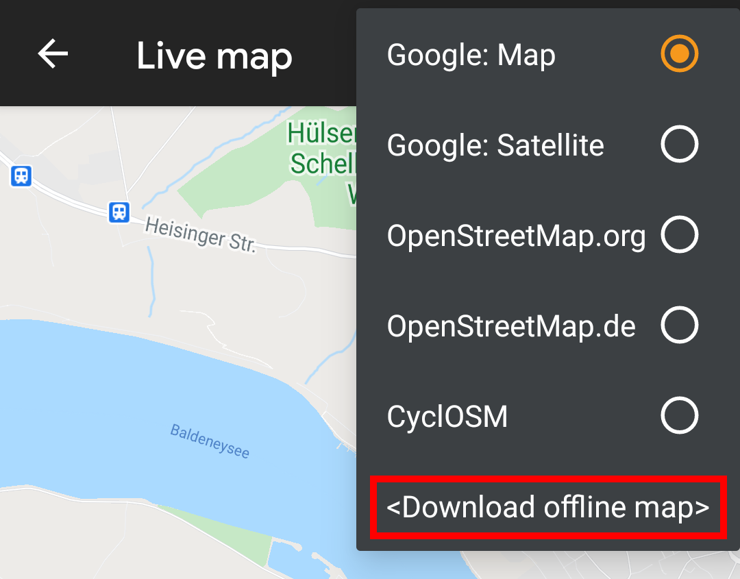
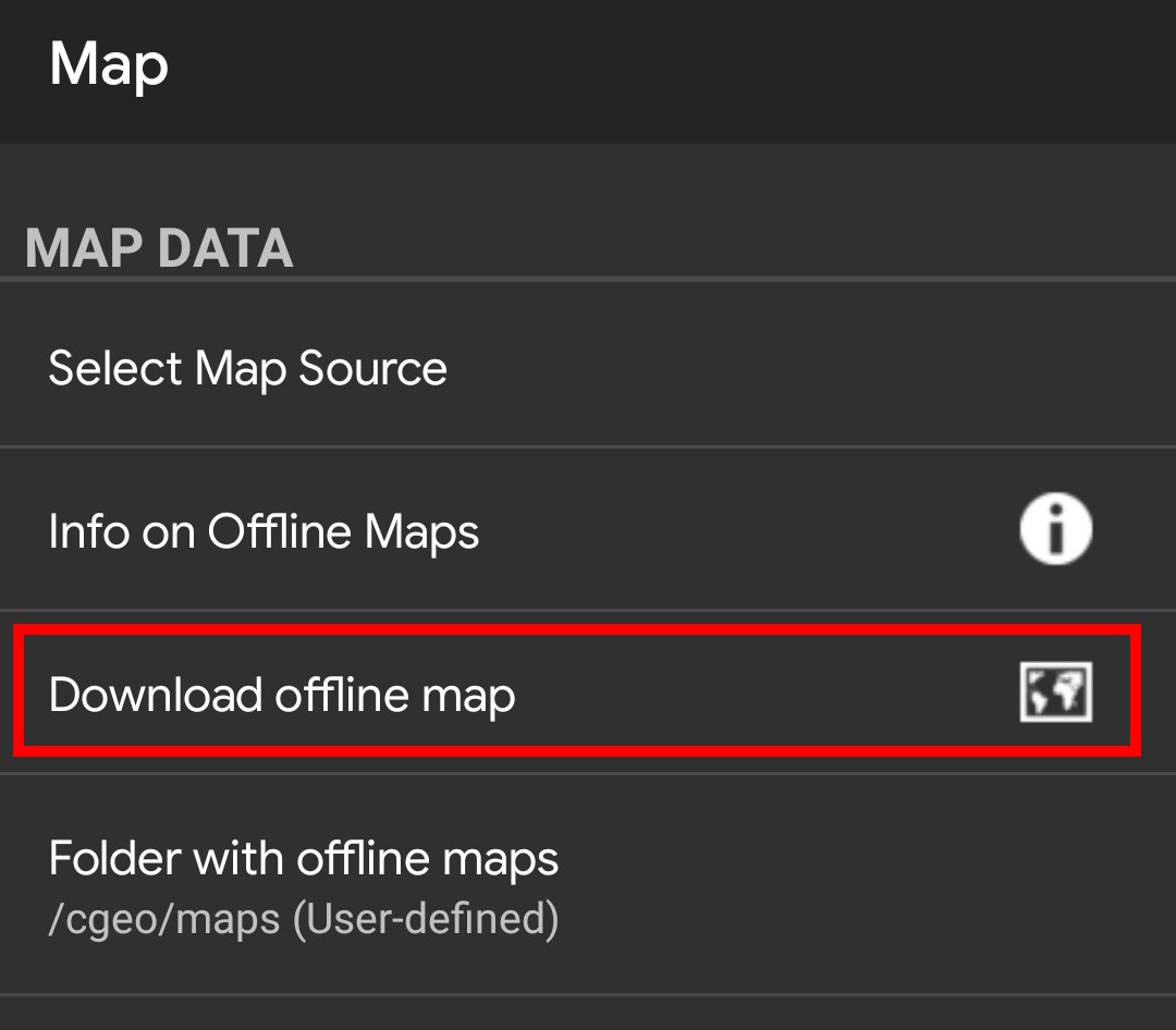
The c:geo map downloader can be started in two ways:
<Download offline map>
Download offline map
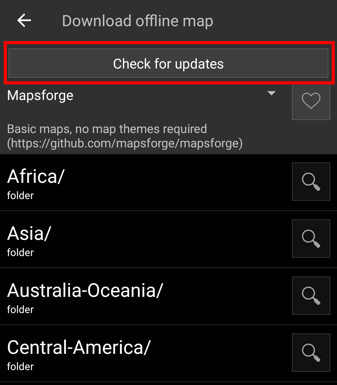
After opening the map downloader you can choose from what source you would like to download the map by opening the drop down menu shown on top. To learn more about the different map sources, please take a look at this list or click on the heart icon shown on top right in the map downloader.
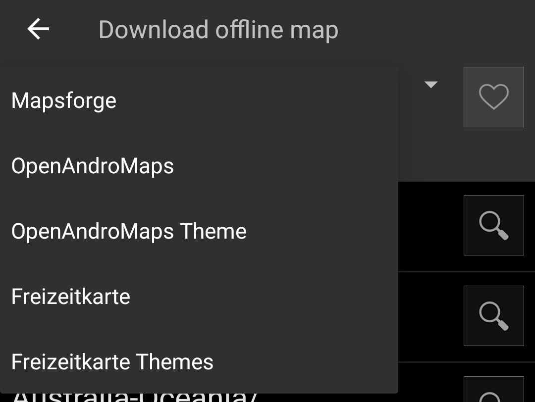
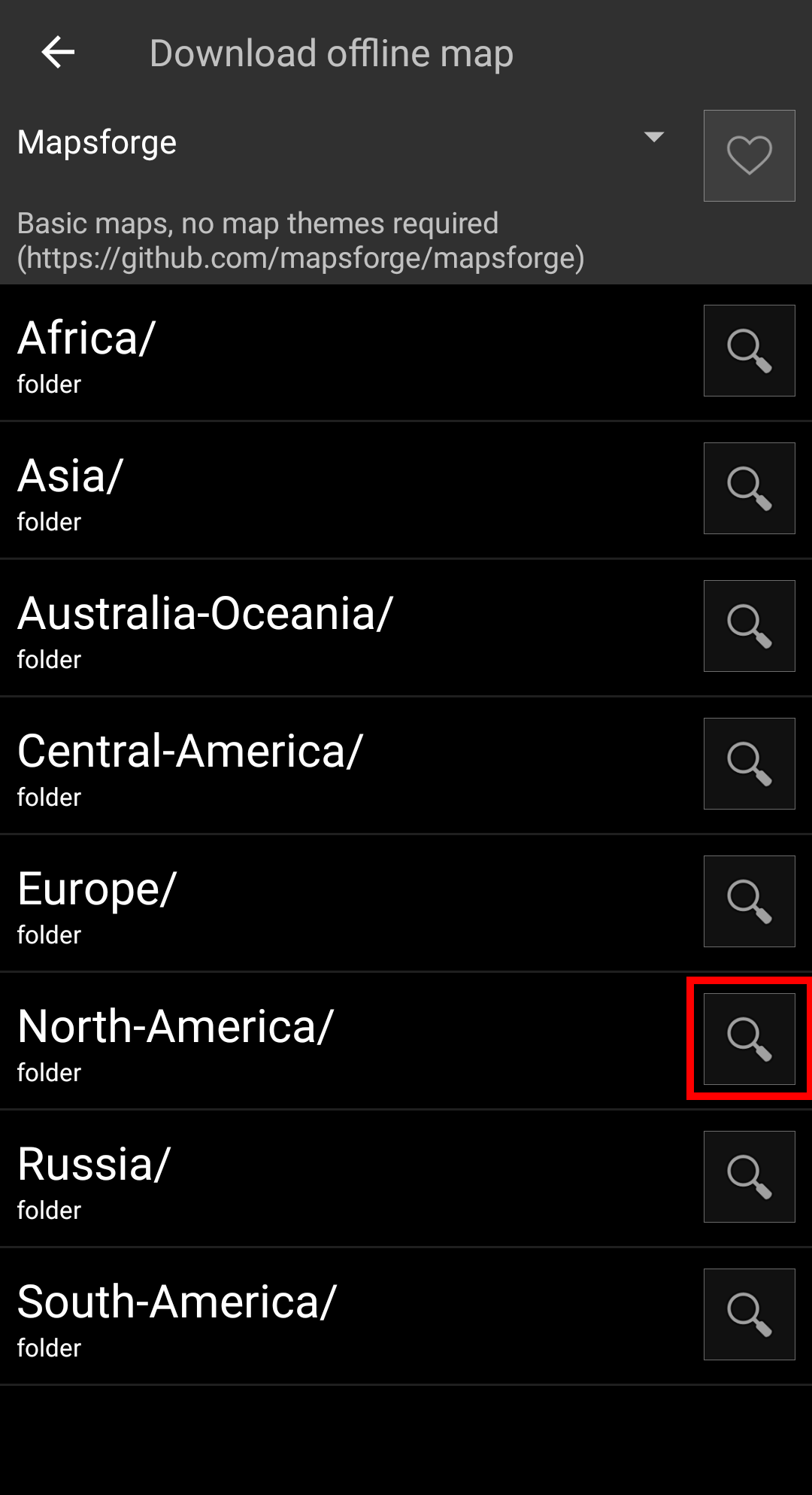
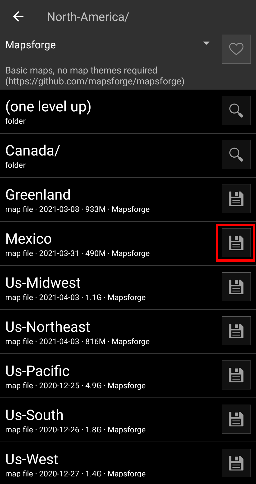
For this example we use “Mapsforge” as map source and want to download the offline map for Mexico.
The top level list is usually sorted by coarse geographical regions (typically: continents) and get more specific on each lower level. Tap on the magnifier icon to open the desired list/region and see its contents. If you finally found the map file you want to install, simply tap on the disc icon next to it to start the download process.
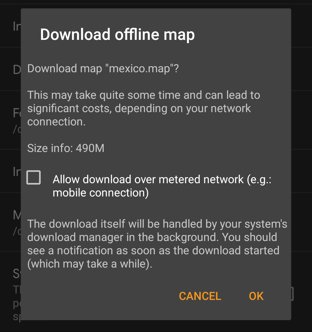
Downloading a map can cause high network traffic! Make sure you use a Wifi or other non-metered network before starting the download.
Confirm the following dialog to start the download.
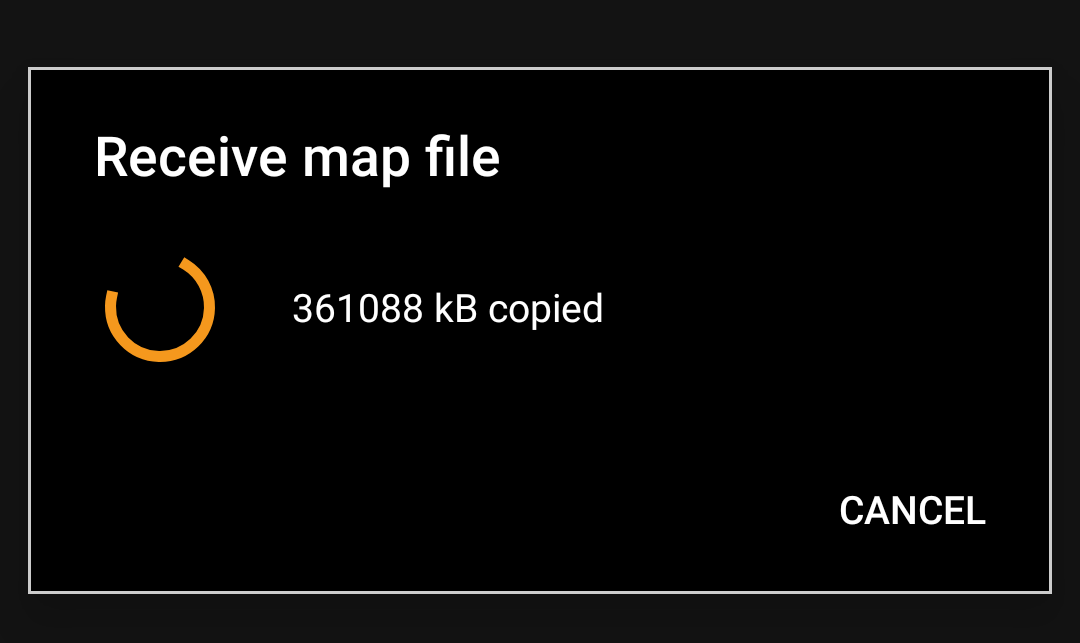
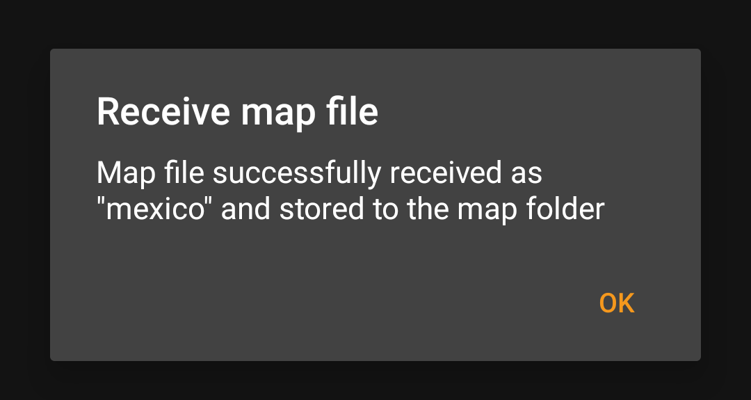
The download itself is performed in the background by the download manager of your device. When the transfer is complete, the file is transfered to the c:geo map folder and set as current map automatically.
Best is to keep c:geo active during the download, so that after the download is completed c:Geo can directly take over the downloaded map.
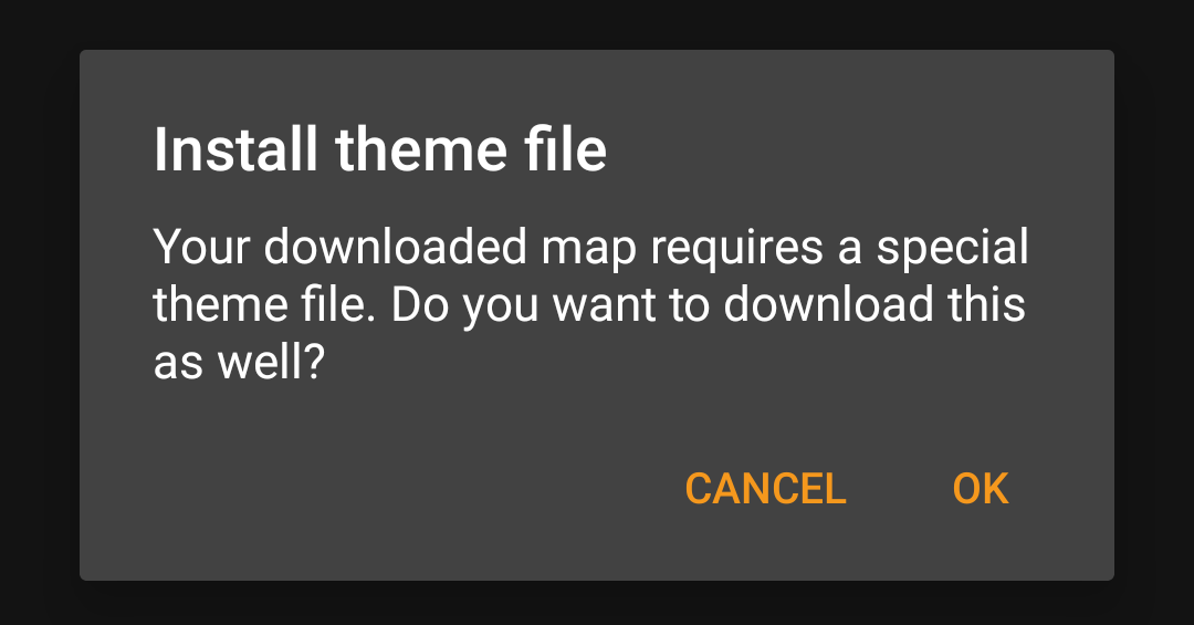
If the downloaded map requires a dedicated map theme (does not apply to Mapsforge) the downloader will afterwards automatically ask you, whether you also want to download and install the needed theme.
This is all you need to do. The downloaded map (and optionally the downloaded theme) will automatically be selected to be used for your map view.
In case you need more than one offline map you can repeat the process as needed.
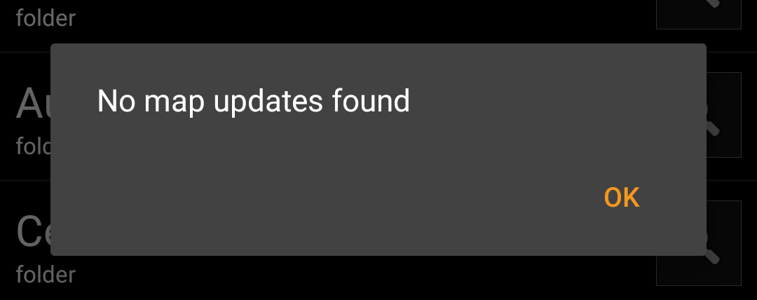
You can also use the map downloader to check for regular updates of your already downloaded maps and themes. Just open the map downloader as described in the chapter above.
Tap on the button Check for updates to let the downloader automatically check, whether there are any newer versions of your downloaded maps and themes available.
The downloader will either show you, that no map update is available or list the files, which can be updated. To update the maps/themes just click the disc icon next to the file name.
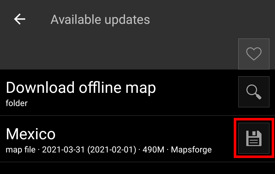
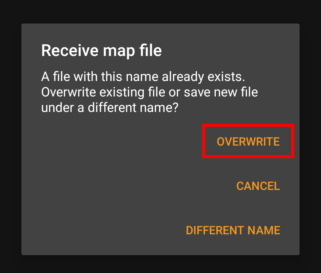
Once the update has been downloaded you will be asked, whether you want to overwrite the existing (older) map or rename the downloaded map. Usually you may want to replace the old map, therefore you should select Overwrite.
You need to repeat the process for each map/theme you would like to update.
c:geo will show all downloaded offline map files in the map selection menu on your (live) map and you can use it to change between your installed offline maps.
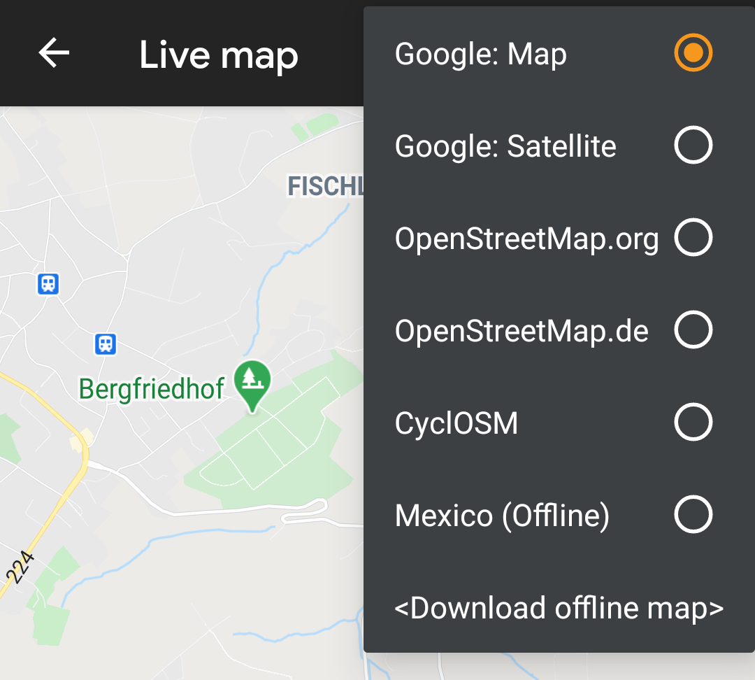
You can also use c:geo Menu → Settings → Map and tap on Select map source to select the offline map to be used.
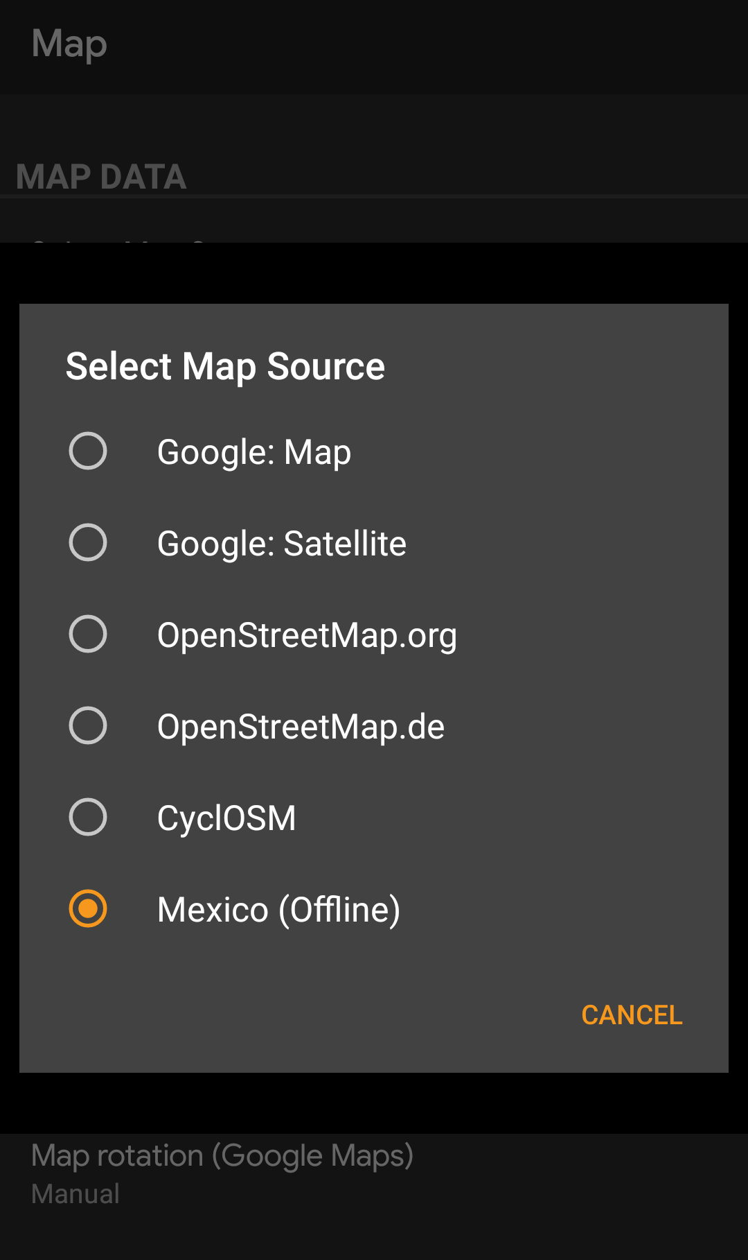
Once selected c:geo will continuously use this map file to render your map instead of using the online maps.
After selecting the offline map file to be used, you can assign the theme, which shall be used to render the map.
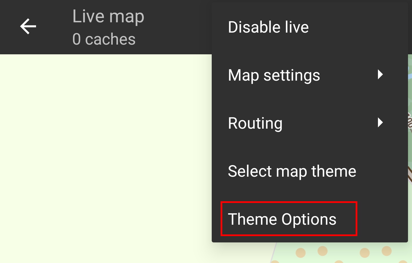
This can be done in the menu of the (live) map using the menu option Select map theme. If you installed a theme alongside with your offline map, please make sure you select the corresponding theme here.

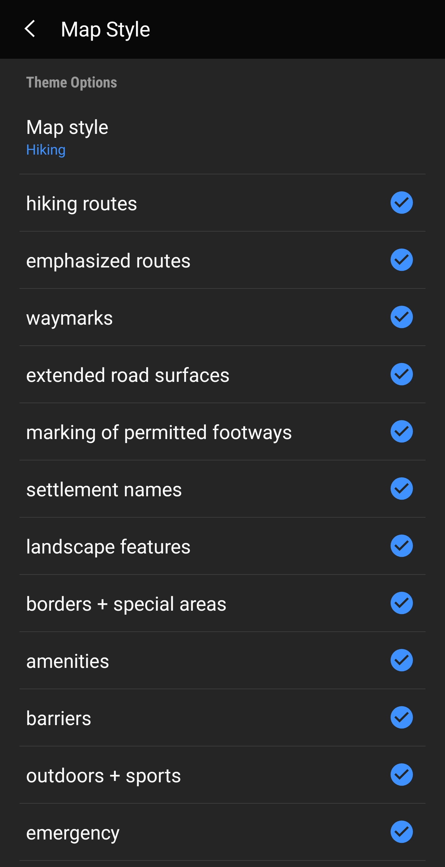
If you installed a theme, you can adjust and configure the visibility of certain map elements according to your need. You can find the related option in the (live) map menu under Theme Options.
Here you can select a basic map style (e.g. Hiking, Cycling, Car) and customize it afterwards by enabling/disabling additional elements of the map.
Link to some guides and tutorials made by c:geo users
| Link | Language | Description |
|---|---|---|
| Saarfuchs Blog | German | Tutorial about c:geo and offline usage |
