Diese Übersetzung ist älter als das Original und ist eventuell veraltet. Änderungen zeigen.
Übersetzungen dieser Seite?:
Dies ist eine alte Version des Dokuments!
 Diese Seite wurde noch nicht vollständig übersetzt. Bitte helfen Sie bei der Übersetzung.
(diesen Absatz entfernen, wenn die Übersetzung abgeschlossen wurde)
Brouter ist eine kleine Android-App, die auf OpenStreetMap basierende navigierte Routen, welche offline berechntet werden, zwischen zwei Koordinaten zur Verfügung stellt.
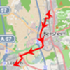
Wenn BRouter auf deinem Gerät installiert und konfiguriert ist, kann c:geo es benutzen, um die normale gerade Linie, die auf der Karte zwischen deiner Position und dem Navigationsziel (Cache/Wegpunkt) angezeigt wird, durch eine geroutete Linie zu ersetzen, wie du im Beispielvergleich unten sehen kannst.
| Navigation ohne BRouter | Navigation mit BRouter |
|---|---|
 |  |
Das Routing kann je nach Bedarf für Gehen, Radfahren oder Autofahren gewählt werden und wird dir helfen, deinen Weg zum Ziel zu finden. Des weiteren kannst du dieses Routing auch zur Erstellung von individuellen Routen über mehrere Wegpunkte hintereinander nutzen, um z.B. deinen Caching-Trip zu planen.
Du kannst BRouter entweder von Google Play oder direkt von der Webseite herunterladen und installieren.
Nachdem BRouter installiert ist, muss noch die Routing-Information für das gewünschte geographische Gebiet in BRouter heruntergeladen werden, damit Routen offline berechnet werden können. Ohne diese heruntergeladenen Routing-Informationen wird BRouter nicht funktionieren (es gibt keine Online-Routingfunktion).
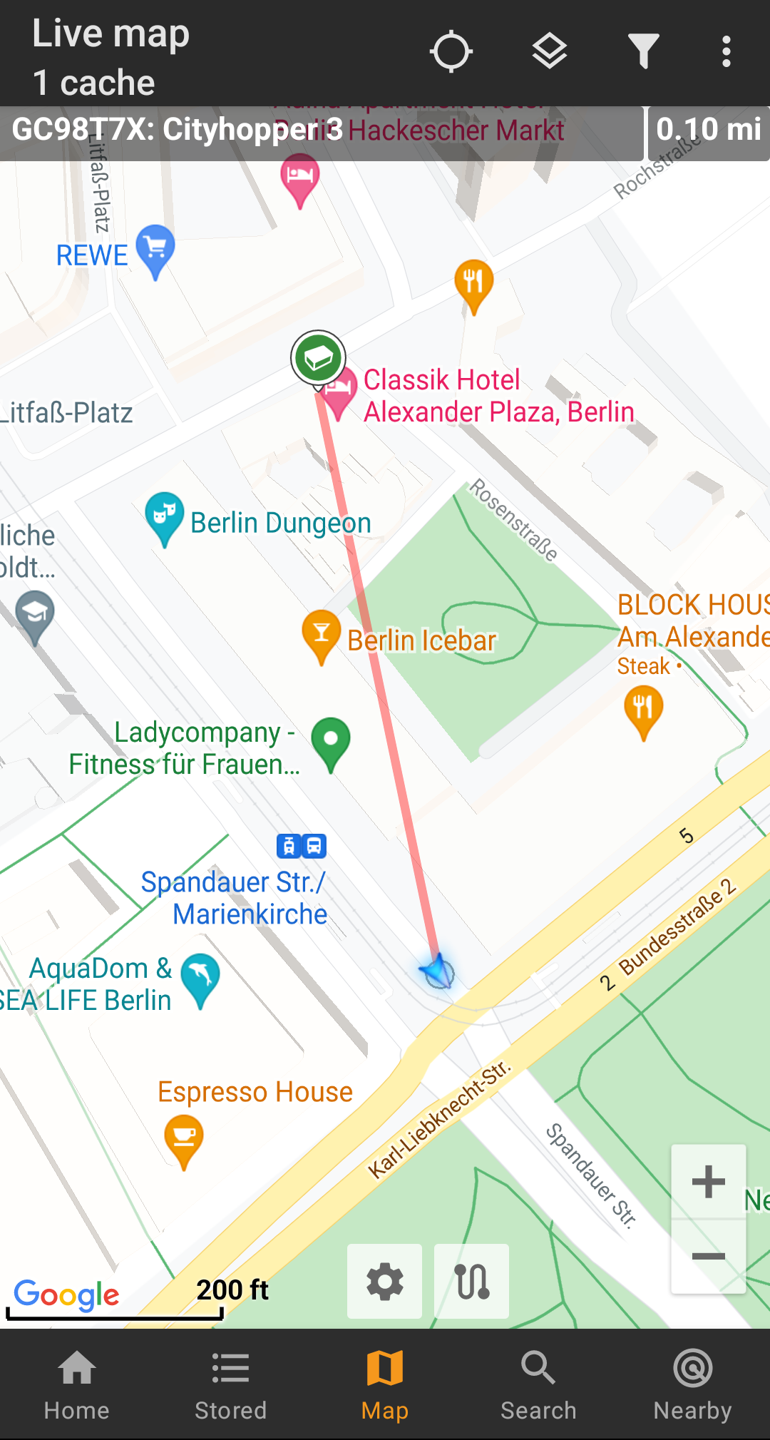
Um die notwendigen Routing-Information herunterzuladen, starte BRouter und wähle Download Manager wie unten dargestellt. Die Funktion BRouter App wird für c:geo nicht benötigt.

BRouter will inform you, that it needs to download a larger amount of data (depending on the size of the geographical area for which you want to download routing information). Make sure you do not use a metered network or have enough quota before you continue by selecting I know.
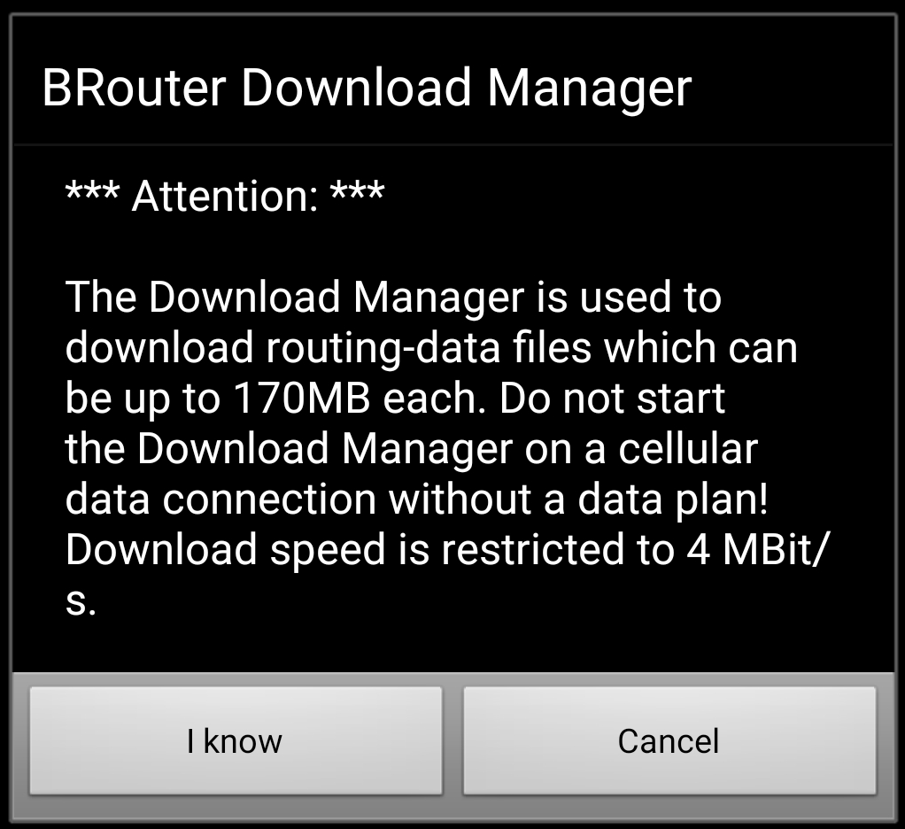
Brouter will now show a world map and you have to touch on the area, for which you want to download routing information, to zoom in and see the grid of the available routing information tiles.
Once you zoomed in you can select the tiles (will be marked in green) of the desired geographical area(s) and select Start Download to trigger the download of routing information for this area.

The download speed is limited by BRouter to 4 Mbit/s. So depending on the amount of routing tiles you selected the download will last a bit. Make sure to keep BRouter open in foreground while the download is in progress.
After successful download the tile map will now show the downloaded tiles in blue.
You are now good to go, but remember, that you need to download new tiles here if you want to use the navigation feature in other geographical areas as those you just downloaded. You might also want to update the existing routing info from time to time be downloading the needed tiles again with this download manager.
Once you installed and configured BRouter as described above, c:geo will use it automatically. There is no need for any configuration in c:geo, except that you might want to change the used routing mode (Bike, Walk, Car) according to your needs. You can do this in the Routing sub menu of your map menu.
BRouter will be used to calculate routes for mainly two functions as described below.
If you invoke navigation to a cache/waypoint using the map, the direction line between your position and the cache/waypoint will now use a routed line instead of a straight line.
The distance information on the top right will show the routed distance additionally to the straight line distance.
To make use of the individual route feature you need to enable the long lick function on the map in your map behavior settings.
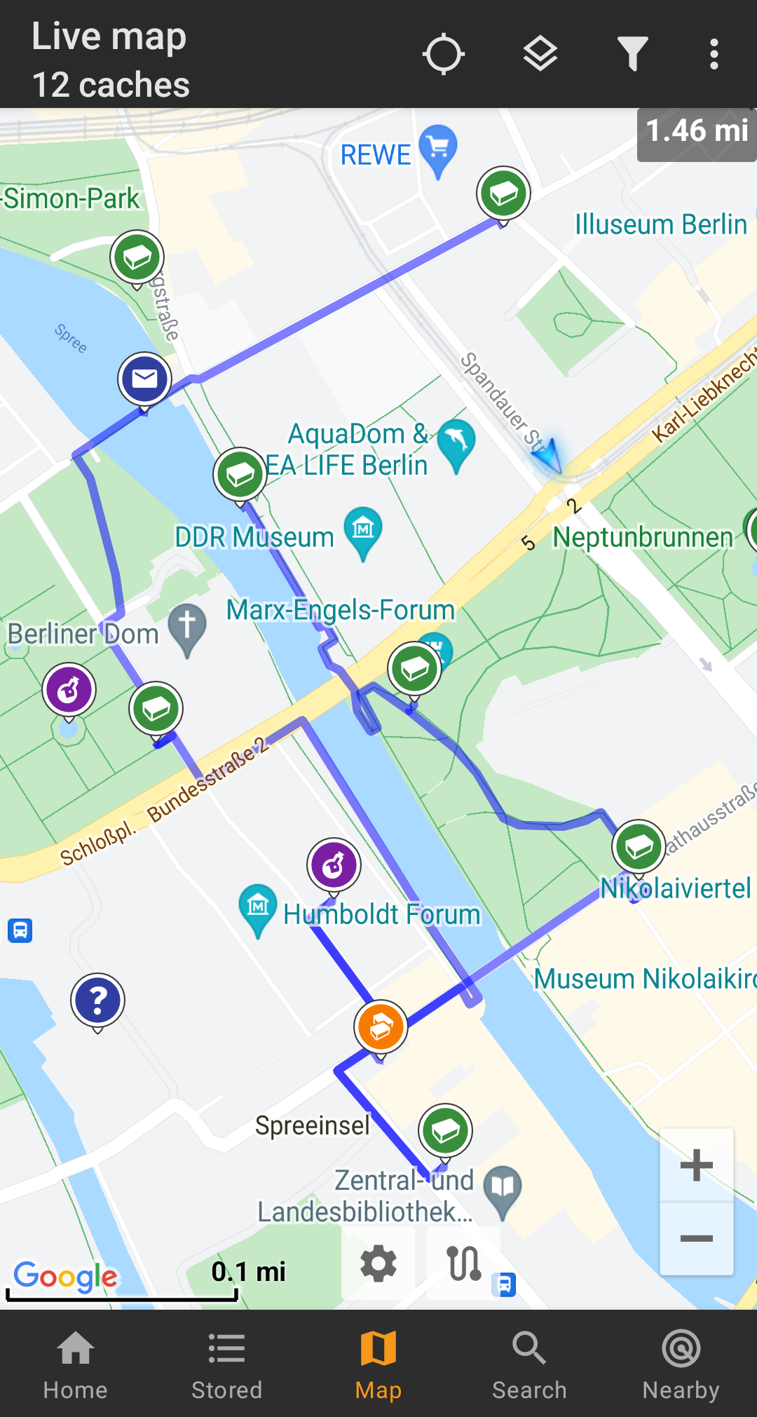
Then you can simply long click sequentially on different caches/waypoints on your map to connect them with a routed line one after another. This function e.g. allows planning of your caching trip as shown in the example below.
To remove one cache/waypoint from your route simply long click it again. Furthermore you can use the sub menu Individual route on your map menu to sort, export, import or clear your individual route.
