Diese Übersetzung ist älter als das Original und ist eventuell veraltet. Änderungen zeigen.
Übersetzungen dieser Seite?:
Dies ist eine alte Version des Dokuments!
 Diese Seite wurde noch nicht vollständig übersetzt. Bitte helfen Sie bei der Übersetzung.
(diesen Absatz entfernen, wenn die Übersetzung abgeschlossen wurde)
Beim Aufruf des Navigationsmenüs zu Koordinaten wird dasfolgende Menü angezeigt, in dem du die passende Navigationsmethode wählen kannst.
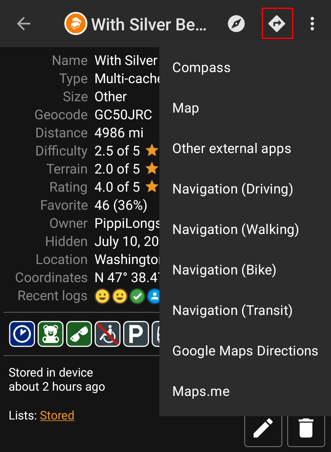
Die nachstehende Tabelle gibt eine Übersicht über die verschiedenen unterstützten Navigationsmethoden und Navigationswerkzeuge. Einige Einträge werden nur angezeigt, wenn das entsprechende Tool auch installiert ist. Außerdem kannst du die angezeigten Einträge in den Einstellungen anpassen.
| Name | Beschreibung |
|---|---|
| Kompass | Starts the c:geo built-in compass. |
| Radar | Starts apps supporting a radar functionality, such as GPS Status & Toolbox. A radar is similar to a compass but showing your position in the center and the target position in relation to this. |
| Karte | Opens the c:geo map |
| Statische Karten | Opens the static maps previously downloaded |
| Statische Karten herunterladen | This option is available only in case static maps have not yet been downloaded and will try to download the static maps. |
| Locus | Starts Locus to display the coordinates on the map. |
| Navigation (Fahren) | Starting Google Maps turn-by-turn navigation using the preferences for a car route. |
| Navigation (Fahrrad) | Starting Google Maps routing turn-by-turn navigation the preferences for a bike route. |
| Navigation (Gehen) | Starting Google Maps routing turn-by-turn navigation the preferences for a walk route. |
| Navigation (ÖPNV) | Starting Google Maps routing turn-by-turn navigation the preferences for a route with transit providers. |
| Street View | Start Google Street View on the coordinates. |
| OruxMaps (Online) | Start OruxMaps using online turn-by-turn navigation. |
| OruxMaps (Offline) | Start OruxMaps using offline turn-by-turn navigation. |
| Sygic (Gehen) | Start Sygic turn-by-turn navigation using preferences for a walk route. |
| Sygic (Fahren) | Start Sygic turn-by-turn navigation using preferences for a car route. |
| OsmAnd | Start OSMAnd offline turn-by-turn navigation. |
| Google Maps Route | Opens Google Maps to show a list of driving directions from your current position to the coordinates. |
| WhereYouGo | This item is only available for WhereiGo caches and will open WhereYouGo to download the needed cartridge and further navigate through the stages of the cache. |
| Pebble | Start compass on your pebble device using the Pebble Navigation app. |
| Maps.me | Start offline turn-by-turn navigation using the maps.me app. |
| Andere externe App | This invokes other apps not explicitly supported by c:geo. Using this option will usually open an app selection dialog on your device presenting all apps capable of digesting links containing coordinates. |
