Sidebar
en:navigation
Navigation methods/tools
When invoking a navigation towards coordinates the following menu will be shown to select an appropriate navigation method/tool.
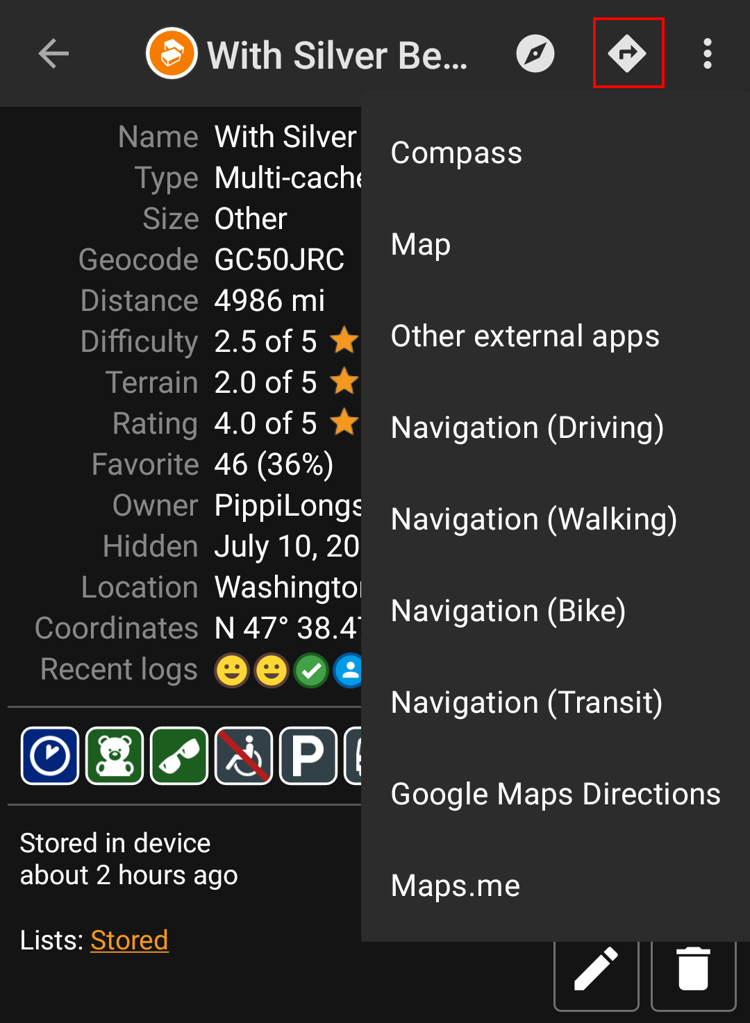
The following table provides an overview of the different methods/tools supported. Some items are only shown if the corresponding tool is installed. You can customize the items shown in this menu in the settings.
| Name | Description |
|---|---|
| Compass | Starts the c:geo built-in compass. |
| Radar | Starts apps supporting a radar functionality, such as GPS Status & Toolbox. A radar is similar to a compass but showing your position in the center and the target position in relation to this. |
| Map | Opens the c:geo map |
| Locus | Starts Locus to display the coordinates on the map. |
| Navigation (Driving) | Starting Google Maps turn-by-turn navigation using the preferences for a car route. |
| Navigation (Bike) | Starting Google Maps routing turn-by-turn navigation the preferences for a bike route. |
| Navigation (Walking) | Starting Google Maps routing turn-by-turn navigation the preferences for a walk route. |
| Navigation (Transit) | Starting Google Maps routing turn-by-turn navigation the preferences for a route with transit providers. |
| Street View | Start Google Street View on the coordinates. |
| OruxMaps (Online) | Start OruxMaps using online turn-by-turn navigation. |
| OruxMaps (Offline | Start OruxMaps using offline turn-by-turn navigation. |
| Sygic (Walking) | Start Sygic turn-by-turn navigation using preferences for a walk route. |
| Sygic (Driving) | Start Sygic turn-by-turn navigation using preferences for a car route. |
| OsmAnd | Start OSMAnd offline turn-by-turn navigation. |
| Google Maps Directions | Opens Google Maps to show a list of driving directions from your current position to the coordinates. |
| WhereYouGo | This item is only available for Wherigo caches and will open WhereYouGo to download the needed cartridge and further navigate through the stages of the cache. |
| Pebble | Start compass on your pebble device using the Pebble Navigation app. |
| Maps.me | Start offline turn-by-turn navigation using the maps.me app. |
| OrganicMaps | Start offline turn-by-turn navigation using the OrganicMaps app. |
| Other external apps | This invokes other apps not explicitly supported by c:geo. Using this option will usually open an app selection dialog on your device presenting all apps capable of digesting links containing coordinates. |
en/navigation.txt · Last modified: by moving-bits
Except where otherwise noted, content on this wiki is licensed under the following license: CC Attribution-Noncommercial-Share Alike 4.0 International
