Diese Übersetzung ist älter als das Original und ist eventuell veraltet. Änderungen zeigen.
Übersetzungen dieser Seite?:
Dies ist eine alte Version des Dokuments!
 Diese Seite wurde noch nicht vollständig übersetzt. Bitte helfen Sie bei der Übersetzung.
(diesen Absatz entfernen, wenn die Übersetzung abgeschlossen wurde)
c:geo unterstützt Openstreetmap-basierte Offline-Vektorkarten, welche das mapsforge-Format nutzen.
Die Nutzung einer Offline-Karte in c:geo in Kombination mit gespeicherten Caches erlaubt es c:geo komplett offline zu nutzen (z.B. wenn du keine mobile Datenverbindung nutzen möchtest oder kannst).
Zusätzlich zu Offline-Karten unterstützt c:geo auch die zugehörigen Kartendesigns. Durch die Nutzung eines angepassten Kartendesigns in Kombination mit einer Offline-Karte kannst du die Kartenansicht nach deinen Bedürfnissen anpassen (z.B. Höhenlinien, Markierung von Wanderwegen und vieles mehr). Einige Offline-Karte benötigen sogar ein passendes Designs, damit sie korrekt dargestellt werden.
Diese Anleitung beschreibt, wie du solche Karten und Designs herunterlädst, installierst und konfigurierst.
c:geo unterstützt ein vollautomatisches Herunterladen und Installieren von Offline-Karten aus diversen Quellen.
Die folgende Tabelle gibt einen Überblick über die Kartenquellen, die vom c:geo Karten-Downloader unterstützt werden:
| Name | Abdeckung | Beschreibung | Anmerkungen | Kosten |
|---|---|---|---|---|
| Mapsforge Kartenserver | Weltweit | Dieser Server beinhaltet weltweite vorgebaute Karte und POIs, die mit dem neuesten Mapsforge-Writer erstellt wurden. | Angepasste Themen-Dateien werden nicht angeboten, die Karten-Dateien funktionieren am besten mit dem c:geo Standardthema. | Kostenfreie Nutzung |
| OpenAndroMaps | Weltweit | OpenAndroMaps bietet herunterladbare Vektorkarten zur freien Nutzung mit Smartphones | Wir empfehlen diese Karten zusammen mit dem passenden OpenAndroMaps-Kartenthema „Elevate 4“ zu nutzen, welches auch auf dieser Webseite heruntergeladen werden kann. | Kostenfreie Nutzung, Spenden willkommen |
| Freizeitkarte OSM | Europe | Kartendaten für Garmin-Geräte und Android-Smartphones. | Sehr detailierte Karten, aber sie benötigen ein passendes Thema (welches auch auf der Webseite heruntergeladen werden kann) um eine korrekte Ansicht zu haben. | Kostenfreie Nutzung, Spenden willkommen |
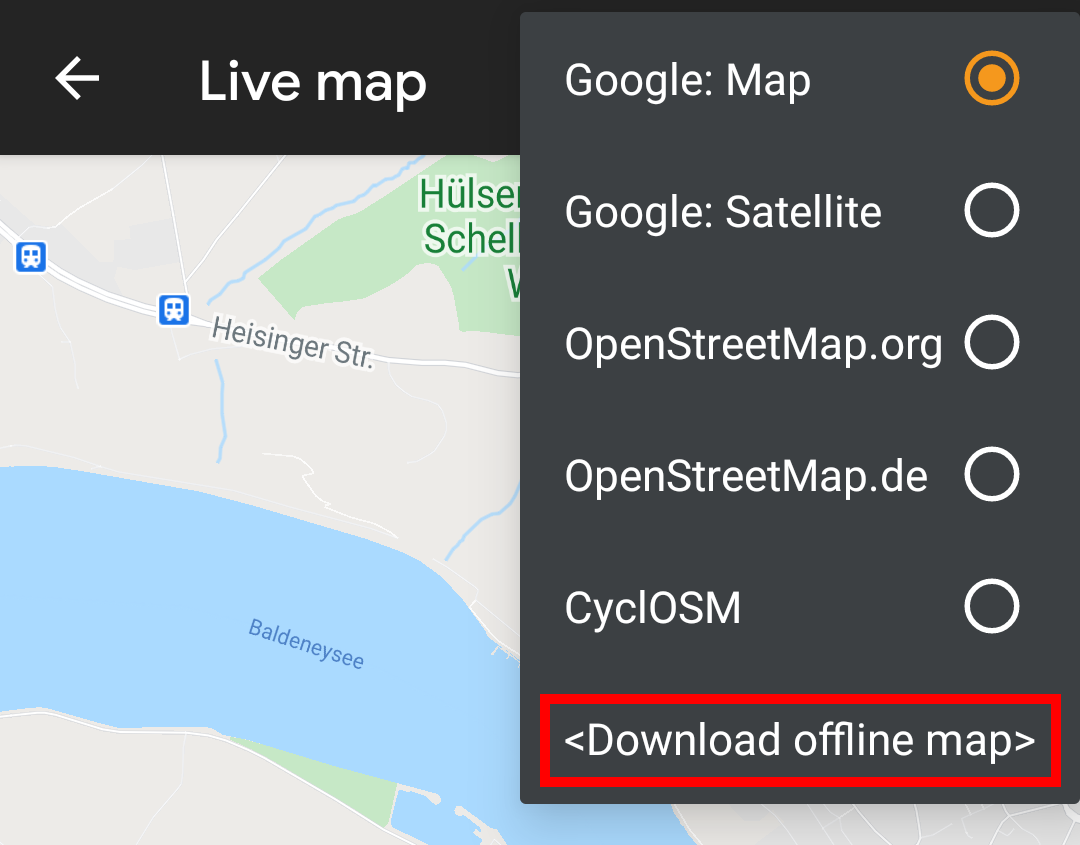
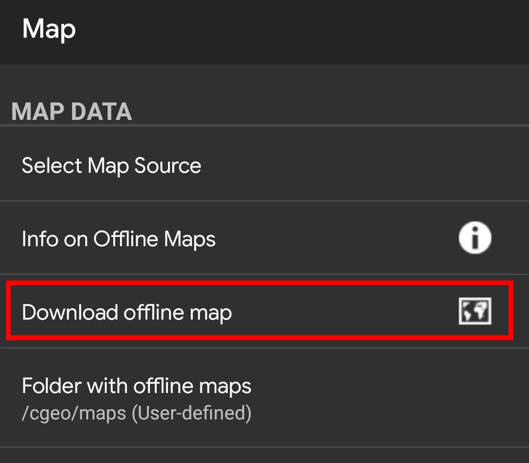
The c:geo map downloader can be started in two ways:
<Download offline map>
Download offline map
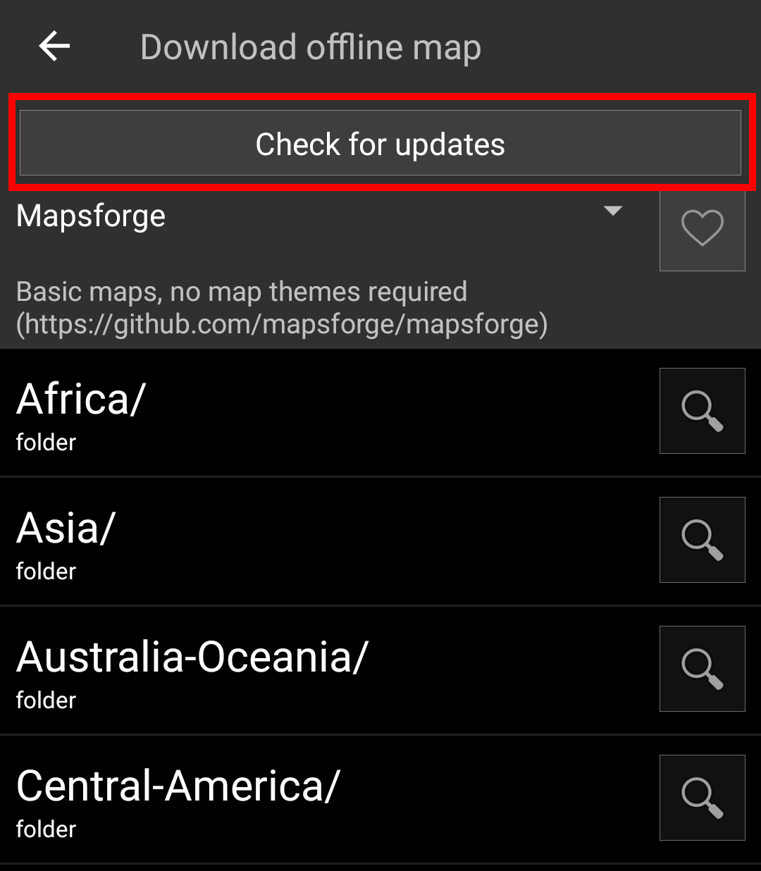
After opening the map downloader you can choose from what source you would like to download the map by opening the drop down menu shown on top. To learn more about the different map sources, please take a look at this list or click on the heart icon shown on top right in the map downloader.
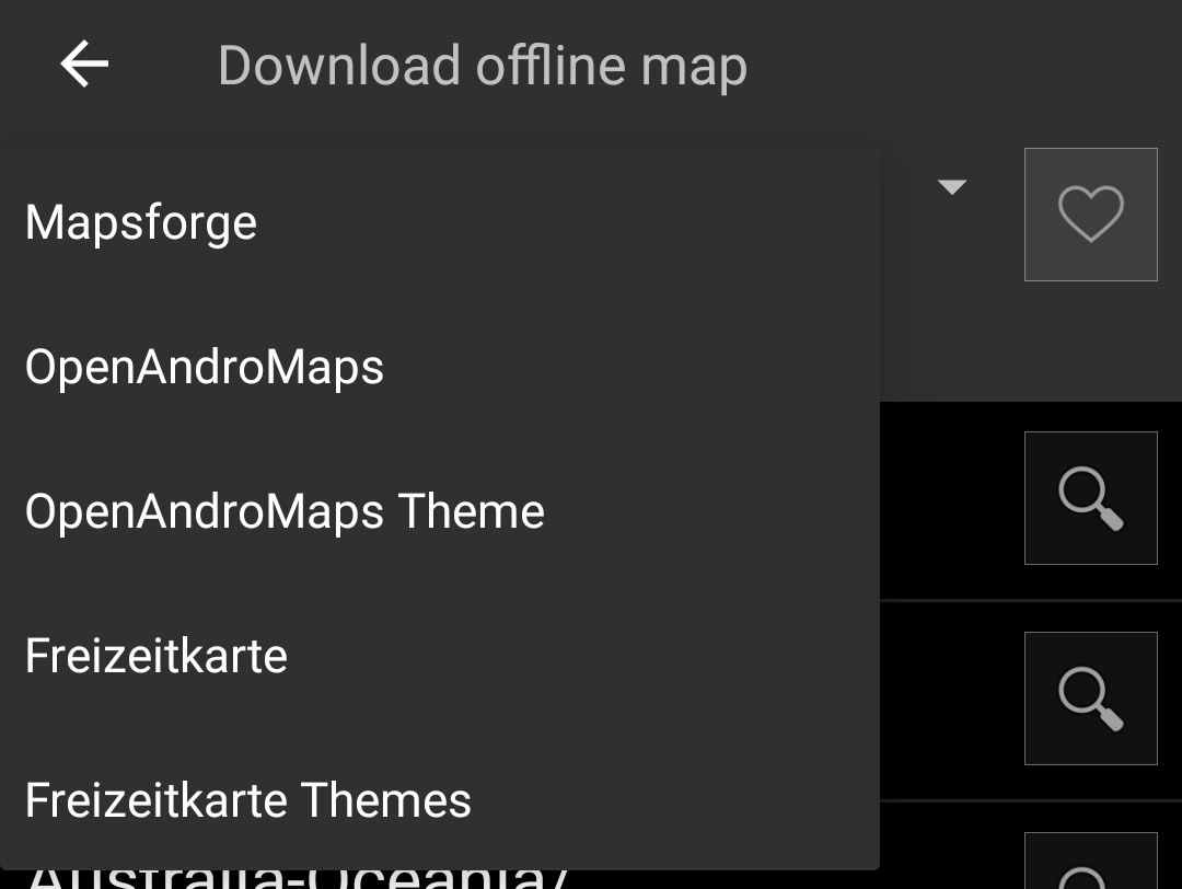
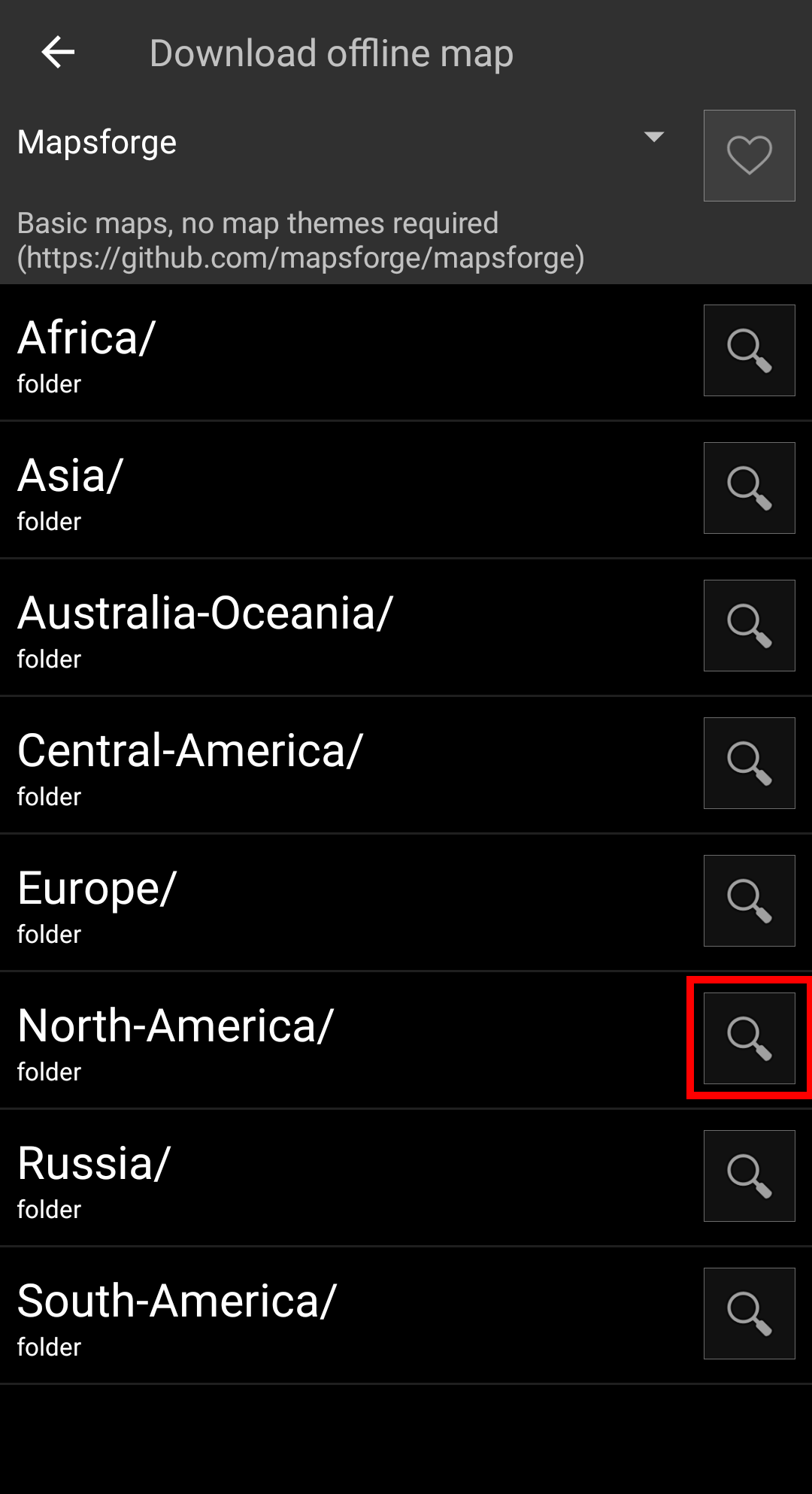
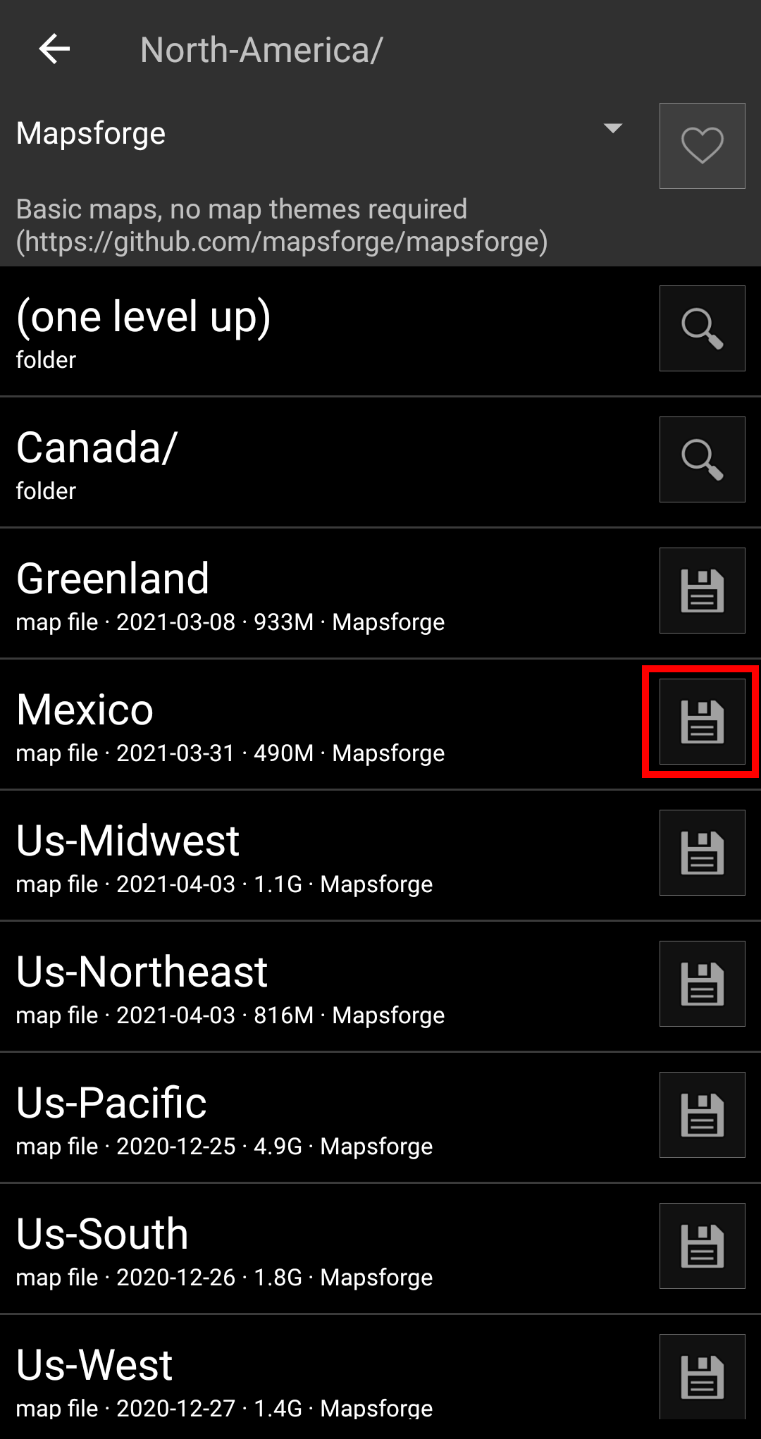
For this example we use „Mapsforge“ as map source and want to download the offline map for Mexico.
The top level list is usually sorted by coarse geographical regions (typically: continents) and get more specific on each lower level. Click on the magnifier icon to open the desired list/region and see its contents. If you finally found the map file you want to install, simply click on the disc icon next to it to start the download process.
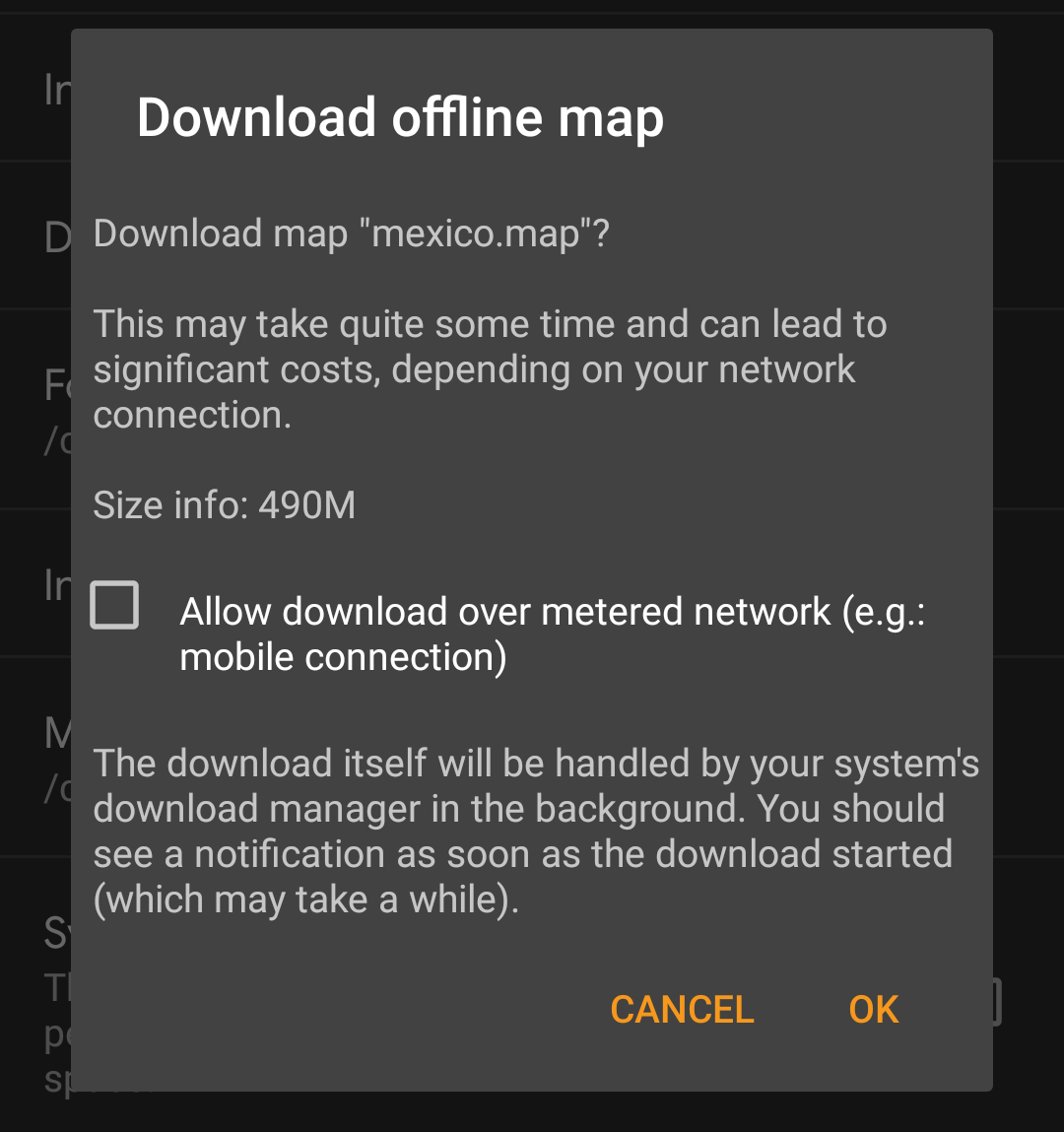
Downloading a map can cause high network traffic! Make sure you use a Wifi or other non-metered network before starting the download.
Confirm the following dialog to start the download.
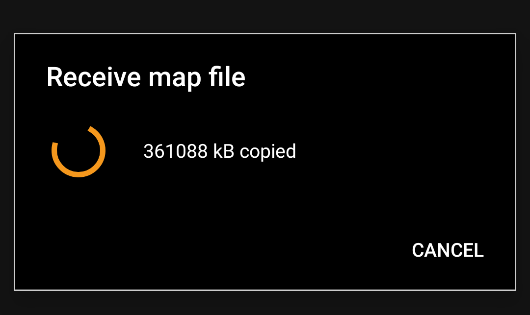
The download itself is performed in the background by the download manager of your device. When the transfer is complete, the file is copied to the c:geo map folder and set as current map automatically.
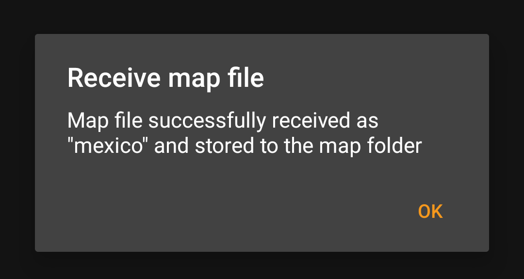
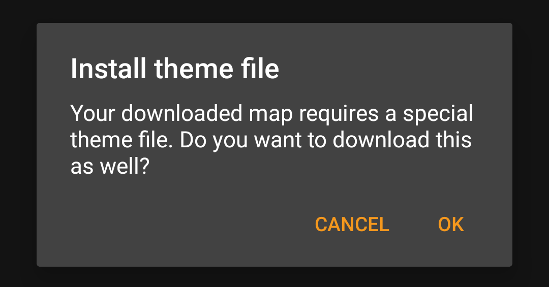
If the downloaded map requires a dedicated map theme (does not apply to Mapsforge) the downloader will afterwards automatically ask you, whether you also want to download and install the needed theme.
This is all you need to do. The downloaded map (and optionally the downloaded theme) will automatically be selected to be used for your map view.
In case you need more than one offline map you can repeat the process as needed.
You can also use the map downloader to check for regular updates of your already downloaded maps and themes. Just open the map downloader as described in the chapter above.
Tap on the button Check for updates to let the downloader automatically check, whether there are any newer versions of your downloaded maps and themes available.
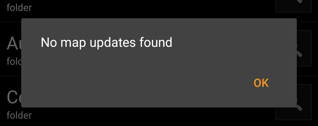
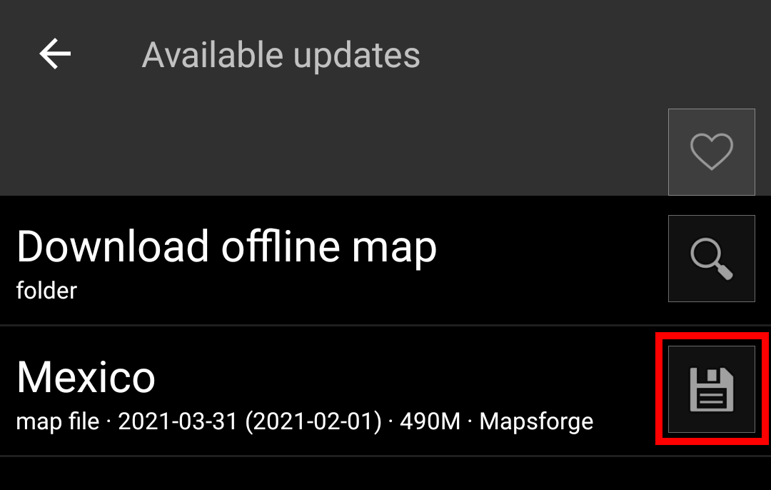
The downloader will either show you, that no map update is available or list the files, which can be updated. To update the maps/themes just click the disc icon next to the file name.
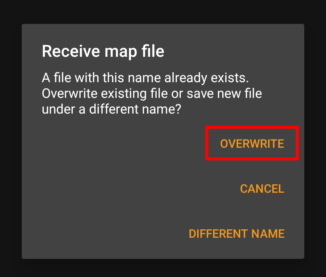
Once the update has been downloaded you will be asked, whether you want to overwrite the existing (older) map or rename the downloaded map. Usually you may want to replace the old map, therefore you should select Overwrite.
You need to repeat the process for each map/theme you would like to update.
c:geo will show all downloaded offline map files in the map selection menu on your (live) map and you can use it to change between your installed offline maps.
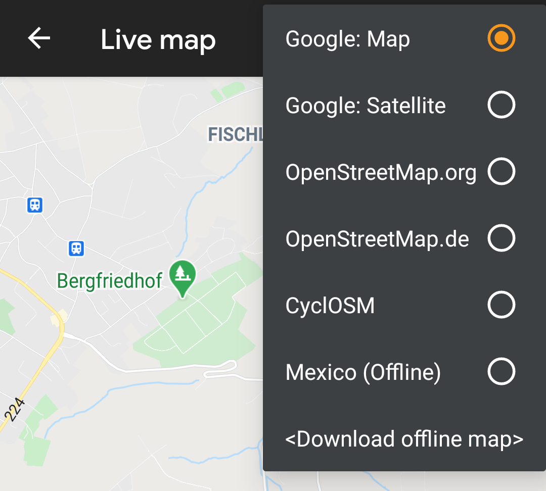
You can also use c:geo Menu → Settings → Map and tap on Select map source to select the offline map to be used.
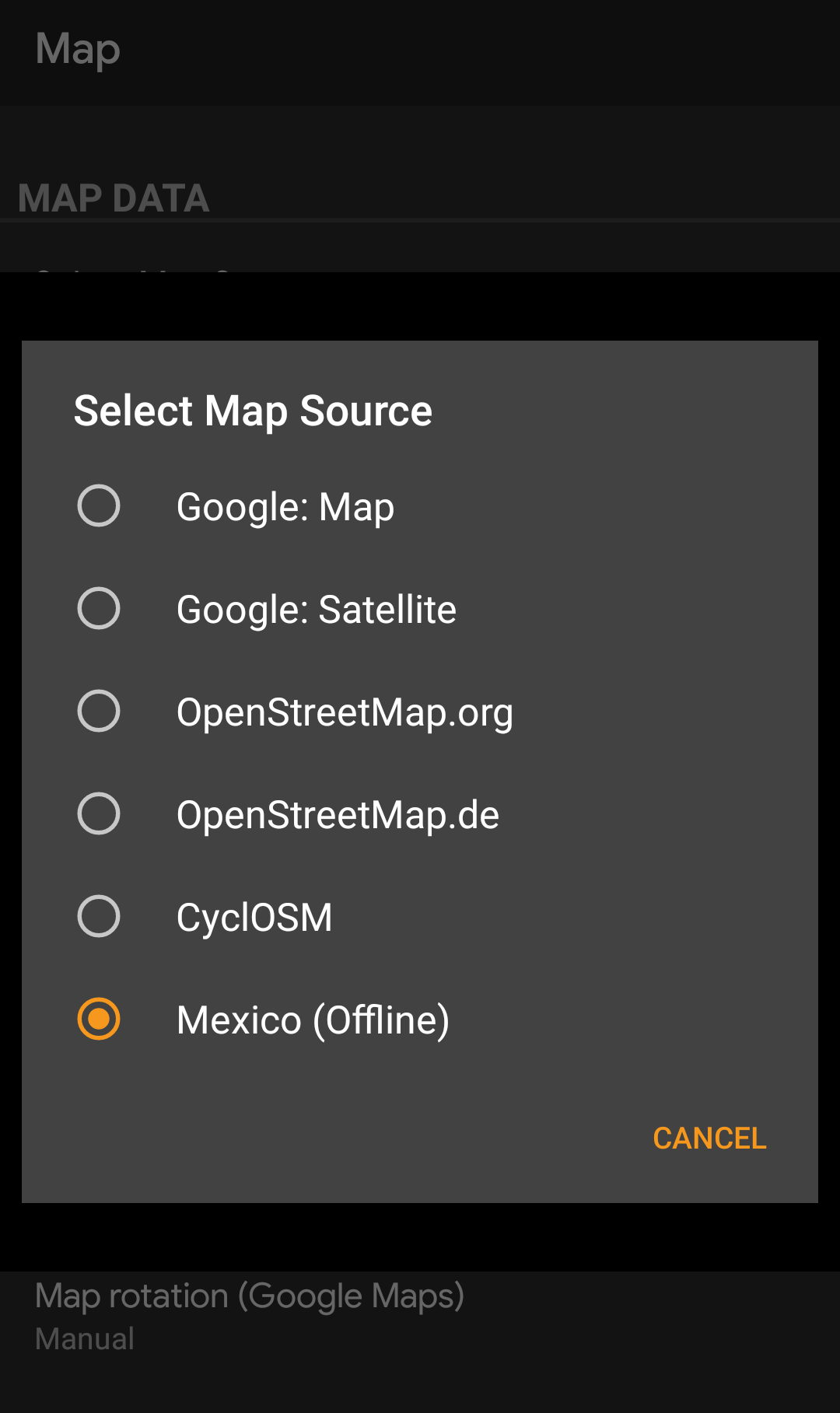
Once selected c:geo will continuously use this map file to render your map instead of using the online maps.
After selecting the offline map file to be used, you can assign the theme, which shall be used to render the map.
This can be done in the menu of the (live) map using the menu option Select map theme. If you installed a theme alongside with your offline map, please make sure you select the corresponding theme here.

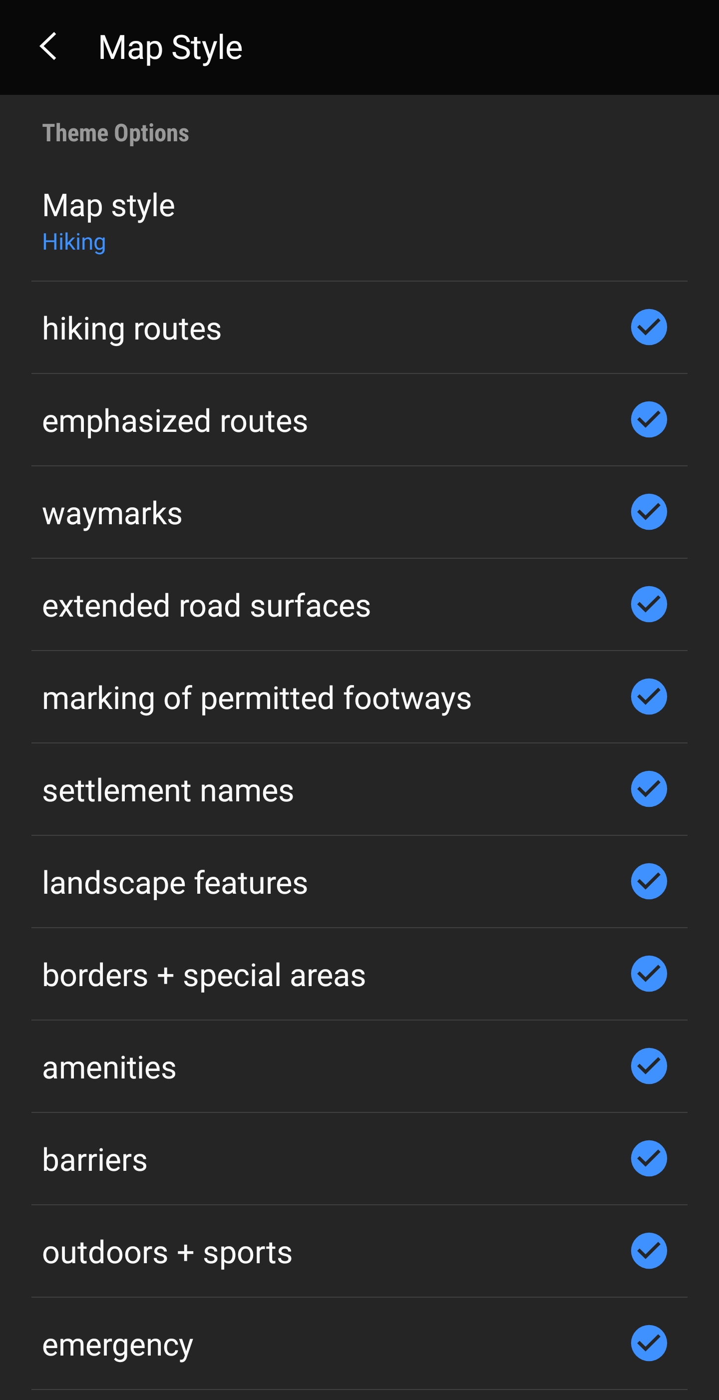
If you installed a theme, you can adjust and configure the visibility of certain map elements according to your need. You can find the related option in the (live) map menu under Theme Options.
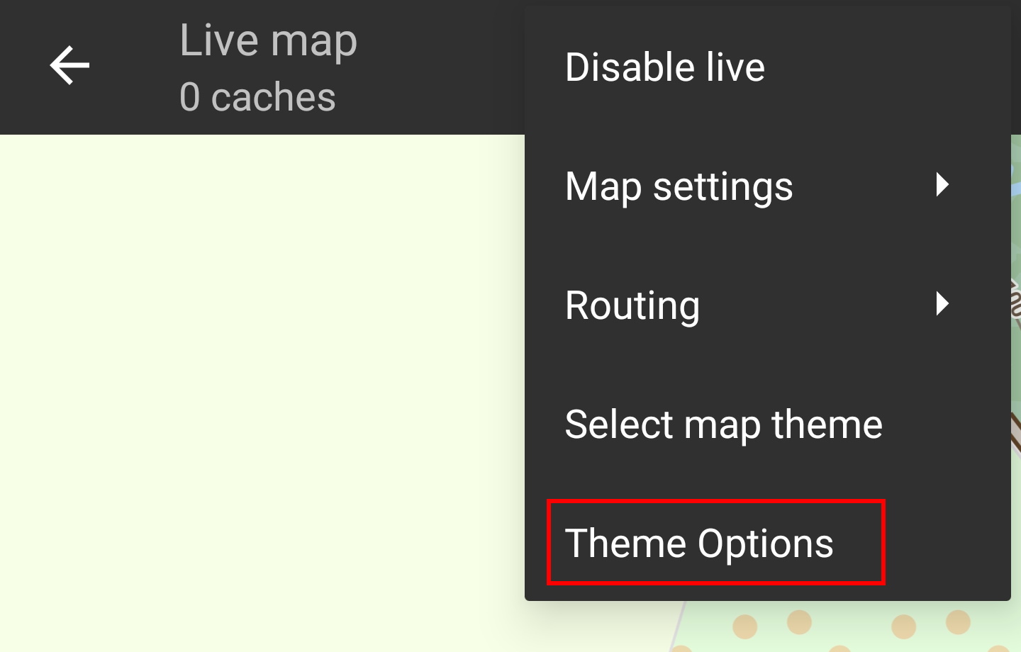
Here you can select a basic map style (e.g. Hiking, Cycling, Car) and customize it afterwards by enabling/disabling additional elements of the map.
Link to some guides and tutorials made by c:geo users
| Link | Language | Description |
|---|---|---|
| Saarfuchs Blog | German | Tutorial about c:geo and offline usage |
