Deze vertaling is ouder dan de originele pagina en kan verouderd zijn. Kijk wat er is veranderd.
Vertaling van deze pagina?:
Dit is een oude revisie van het document!
 Deze pagina is nog niet volledig vertaald. Help alsjeblieft de vertaling compleet te maken.
(verwijder deze paragraaf als de vertaling is voltooid)
c: geo ondersteunt op Openstreetmap gebaseerde offline vectorkaartbestanden met de indeling mapsforge.
Met behulp van een offline kaart in C:geo in combinatie met opgeslagen caches kun je c:geo volledig offline gebruiken (bijvoorbeeld als je geen mobiele gegevensverbinding wilt of kunt gebruiken).
Naast offline kaartbestanden ondersteunt c:geo ook gerelateerde kaartthema's. Door een aangepast kaartthema te gebruiken in combinatie met een offline kaart, kun je de kaartweergave aanpassen aan je eigen behoeften (bijv. Hoogtelijnen, markering van wandelpaden en nog veel meer). Sommige offline kaarten vereisen zelfs dat een passend thema wordt geïnstalleerd om correct te worden weergegeven.
In deze zelfstudie wordt beschreven hoe je dergelijke offline kaarten en thema's kunt downloaden, installeren en configureren.
Ten eerste dien je een offline kaart bestand te downloaden die compatibel is en het geografische gebied bestrijkt. Er zijn enkele diensten beschikbaar op het internet die met enige regelmaat actuele kant-en-klare kaart bestanden aanbieden,
Hier zijn enkele bronnen waar je een offline kaart kunt downloaden:
| Naam | gebied omschrijving | Compatibiliteit | Kosten | |
|---|---|---|---|---|
| Mapsforge Map Repository | Wereld | Deze server host wereldwijd vooraf gebouwde kaarten en POI's die zijn gegenereerd met de laatste versie van de mapsforge-writer plug-ins. Gebruik s.v.p. deze mirrorserver voor je kaartdownloads. | Kaarten in de mappen V4 en V5 zijn compatibel met c: geo. V3-kaarten kunnen worden gebruikt als je “Oude Mapsforge V3” in c: geo's instellingen inschakelt, aangepaste themabestanden worden niet aangeboden, de kaartbestanden werken het beste bij het gebruik van het c:geo standaardthema. | Gratis |
| OpenAndroMaps | Wereld | OpenAndroMaps biedt gratis downloadbare vectorkaarten voor smartphones. | Gebruik de link “Meertalige V4-kaart” om de compatibele versie van de kaart te downloaden. We raden aan om deze kaarten te gebruiken in combinatie met het bijpassende OpenAndroMaps-kaartthema “Elevate4” dat ook op hun website kan worden gedownload. | Gratis, Donaties worden erg gewaardeerd |
| Freizeitkarte OSM | Europa | Kaartbestanden voor Garmin-apparaten en Android-smartphones. | Zeer gedetailleerde kaarten, maar vereist het bijbehorende thema (ook beschikbaar om te downloaden op hun website) voor een juiste weergave. | Frratis, Donaties worden erg gewaardeerd |
De bovenstaande tabel geeft slechts enkele voorbeelden van kaartproviders, er zijn nog meer providers aanwezig.
Gebruikers meldden dat sommige (verkoper) tools, die worden gebruikt om bestanden tussen pc en smartphone over te zetten, de bestanden tijdens de overdracht kunnen beschadigen of wijzigen. Daarom raden we aan om alle bestanden rechtstreeks naar je smartphone te downloaden en een goede bestandsverkenner op het apparaat te gebruiken om de bestanden te decomprimeren / kopiëren / verplaatsen zoals hieronder beschreven.
Het gedownload kaartbestand moet worden opgeslagen op je apparaat in de map van je keuze. Als de bestanden zijn ingepakt (*.zip) moet je ze eerst uitpakken. De correcte extensie van het bestand is *.map (bijv. netherlands.map).
Als je verschillende kaartbestanden wilt gebruiken met c:geo dien je ze allemaal in dezelfde map op te slaan. Zodra c:geo is geconfigureerd zullen de kaarten in de specifieke map worden gezocht en zullen ze allemaal te selecteren zijn in c:geo.
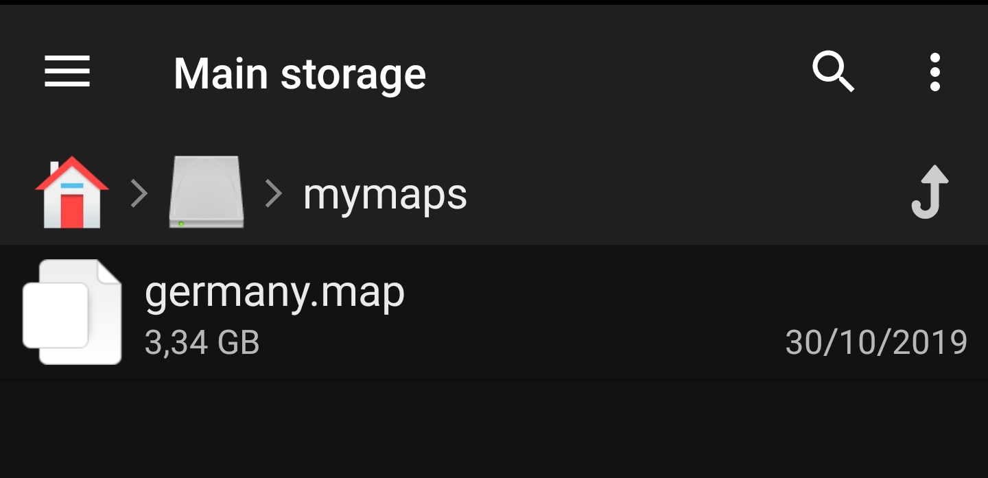
Voor deze tutorial gaan we er vanuit dat de kaart wordt opgeslagen in /sdcard/mymaps.
If you (optionally) also downloaded a theme file for your offline map, you need to store it onto your device it in addition to the map files.
Typically the downloaded theme is compressed (*.zip) and needs to be extracted before it can be used by c:geo. The compressed file usually contains some folders and a lot of small files. Please make sure you keep this structure untouched when decompressing the file.
All of the resulting folders and files need to be stored below a folder of your choice on your device.
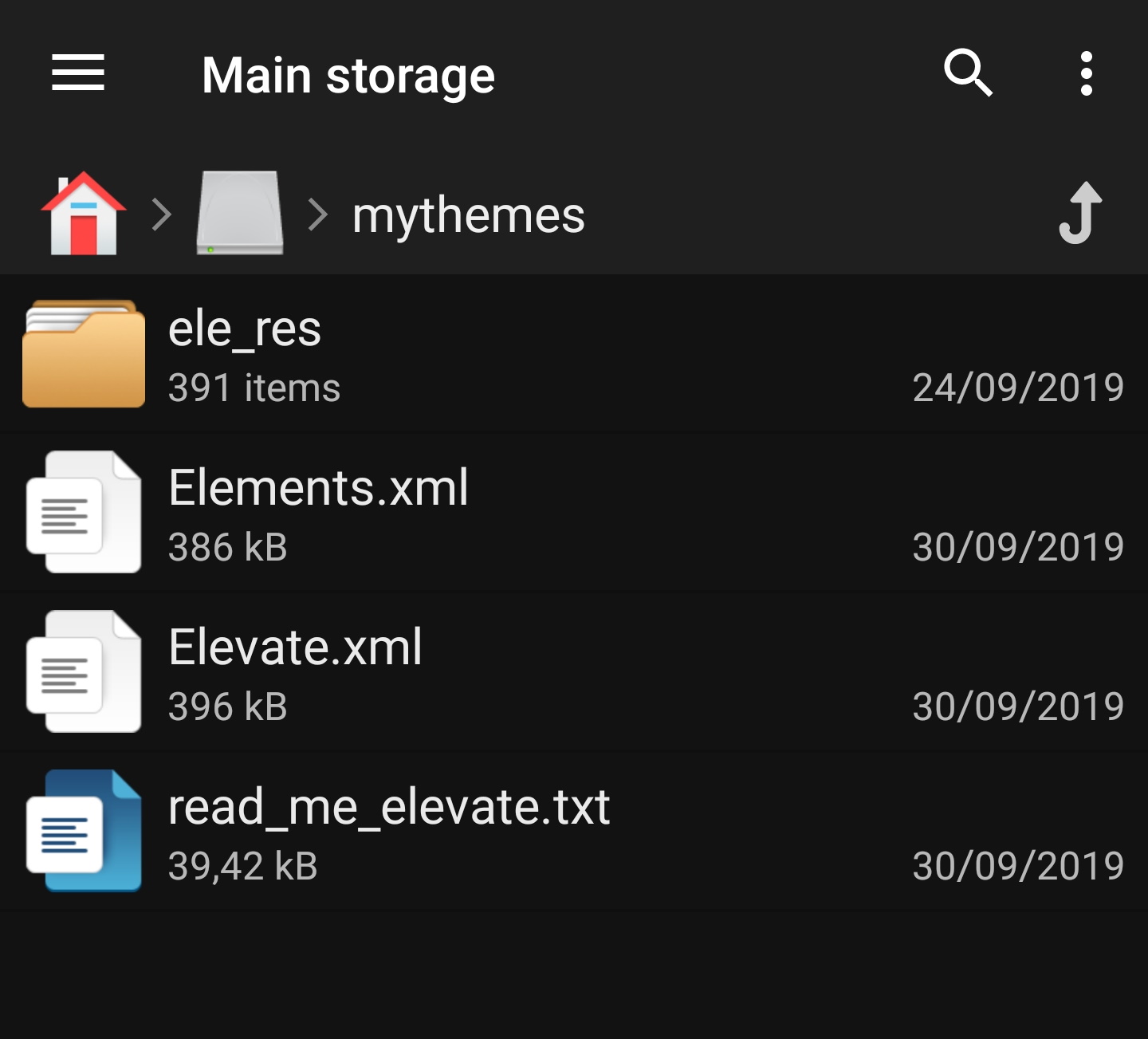
For this tutorial, let us assume you stored the theme(s) to /sdcard/mythemes.
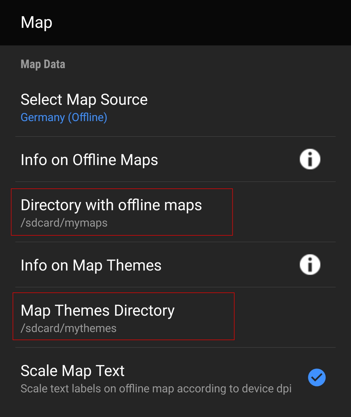
Once you finished storing the map files (and optionally themes) onto your device, you need to configure c:geo to use the correct directories for finding the maps/themes.
You will find the corresponding settings in c:geo Menu → Settings → Map. A detailed description of this setting menu can be found here.
At the beginning the related settings will be empty:
![]()
In this menu you need to select the directory, where you have stored the map files (and themes) in the previous step of this tutorial. Sticking to our example above you need to configure the following directories here:
| Menu item | Setting |
|---|---|
| Directory with offline maps | /sdcard/mymaps |
| Map Themes Directory | /sdcard/mythemes |
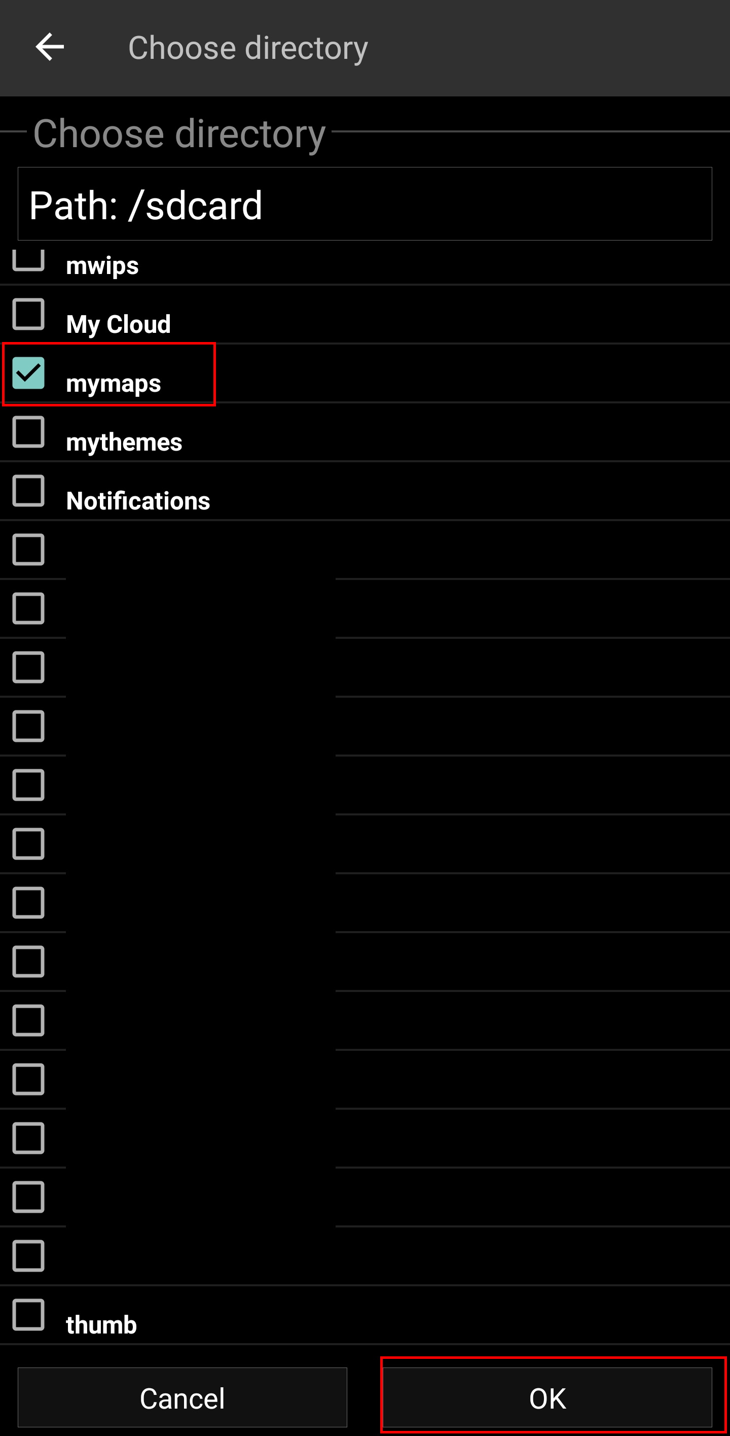
To select these folders simply click on the related menu item. c:geo will then automatically scan your folders trying to find the map files and offer the corresponding directory to be selected. If the list already contains the correct directory you can directly select it, if your map/theme directory is not listed you have to click the Choose directory button at the top to manually select/enter the directory.

On some devices finding the right folder might be frustrating, as the same folder is mounted under different paths at the same time, whereas the visibility of these paths might be different from app to app. A typical example is, that /sdcard/mymaps might instead be shown as /storage/emulated/0/mymaps or something like /storage/1234-5678/mymaps.
Due to the many different implementations depending on vendor, model, Android version and device configuration, we can't give a generic information, but you have to find the correct path on your device.
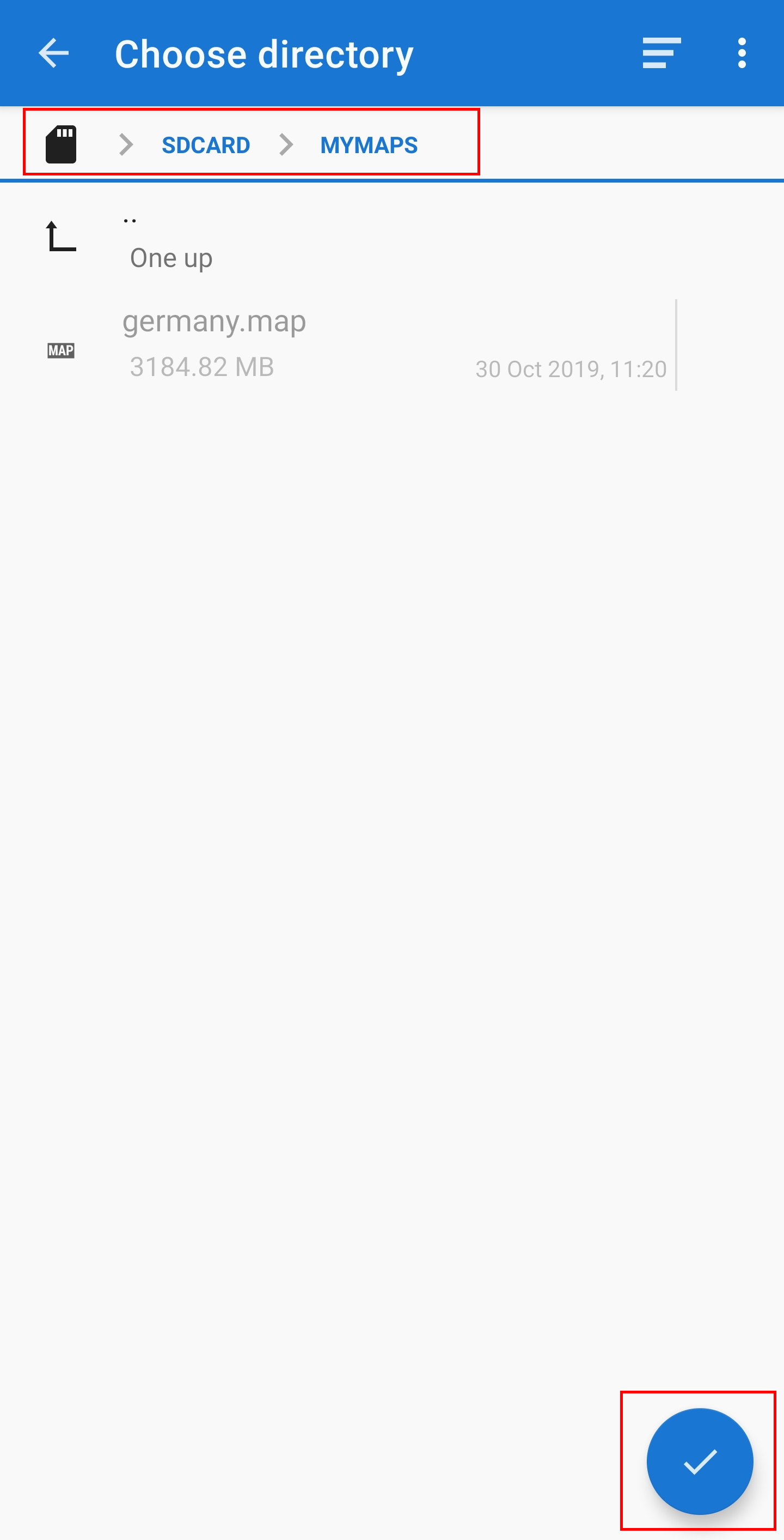
If you select Choose Directory some file explorer (appearance differs depending on Android version and installed third-party tools) will be opened, where you can browse your folders and choose the correct directory.
The following pictures show two different typical file explorers and visualize the steps needed to browse and select your map folder according to our example. For setting up the theme folder the steps are identical, but you need to select the themes folder instead.
Staying in our example the directory configuration should be shown look like this in the menu at the end:
Now you are ready to use your map files (and themes) with c:geo.
After adding new maps/themes to the configured directories a restart of c:geo is needed to recognize the added files.
If you correctly configured the directories, c:geo will now show all available offline map files in the map selection menu on your (live) map and in c:geo Menu → Settings → Map.
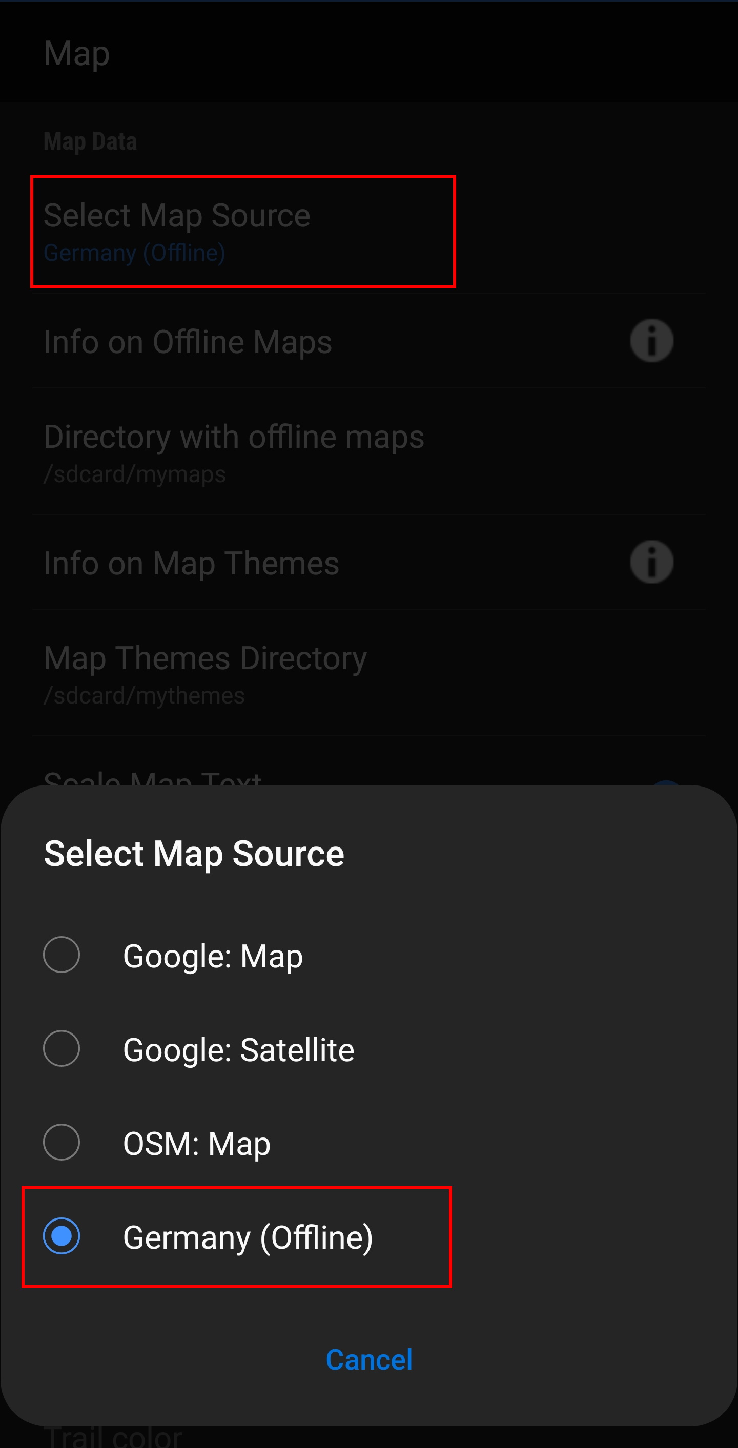
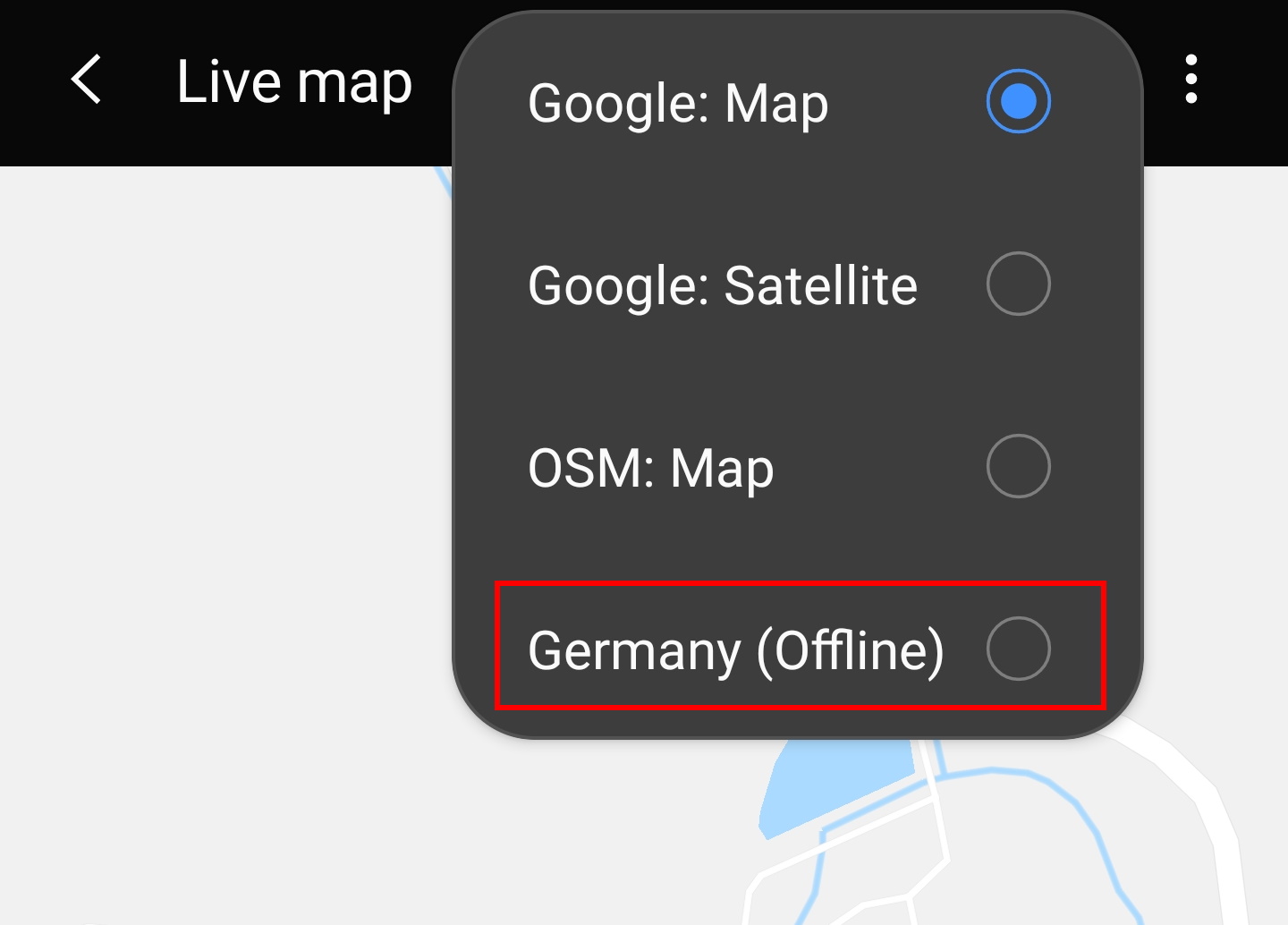
Once selected c:geo will continuously use this map file to render your map instead of using the online maps.
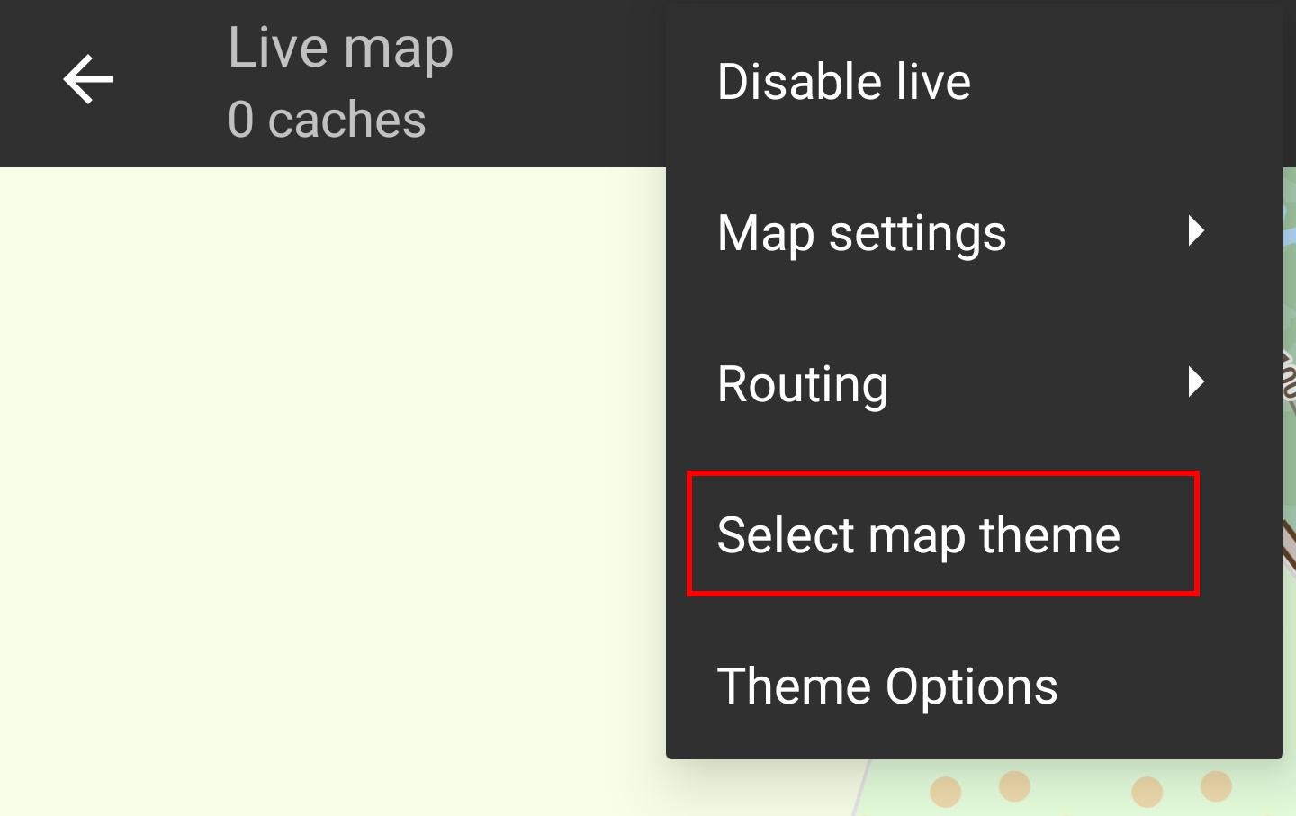
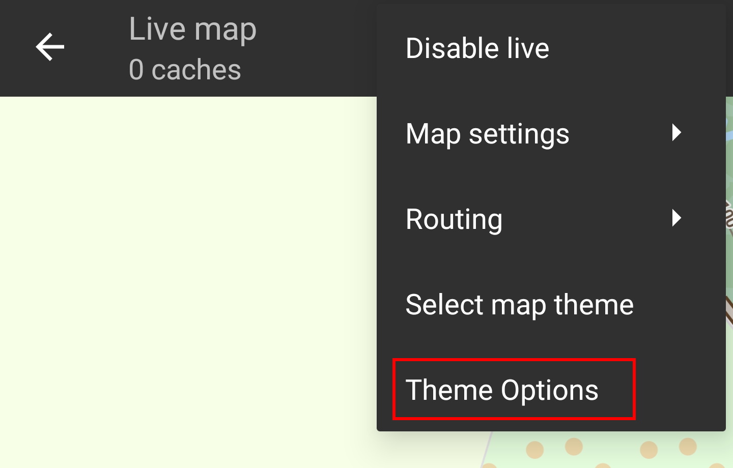
After selecting the offline map file to be used, you can assign the theme, which shall be used to render the map.
This can be done in the menu of the (live) map using the menu option Select map theme. If you installed a theme alongside with your offline map, please make sure you select the corresponding theme here.

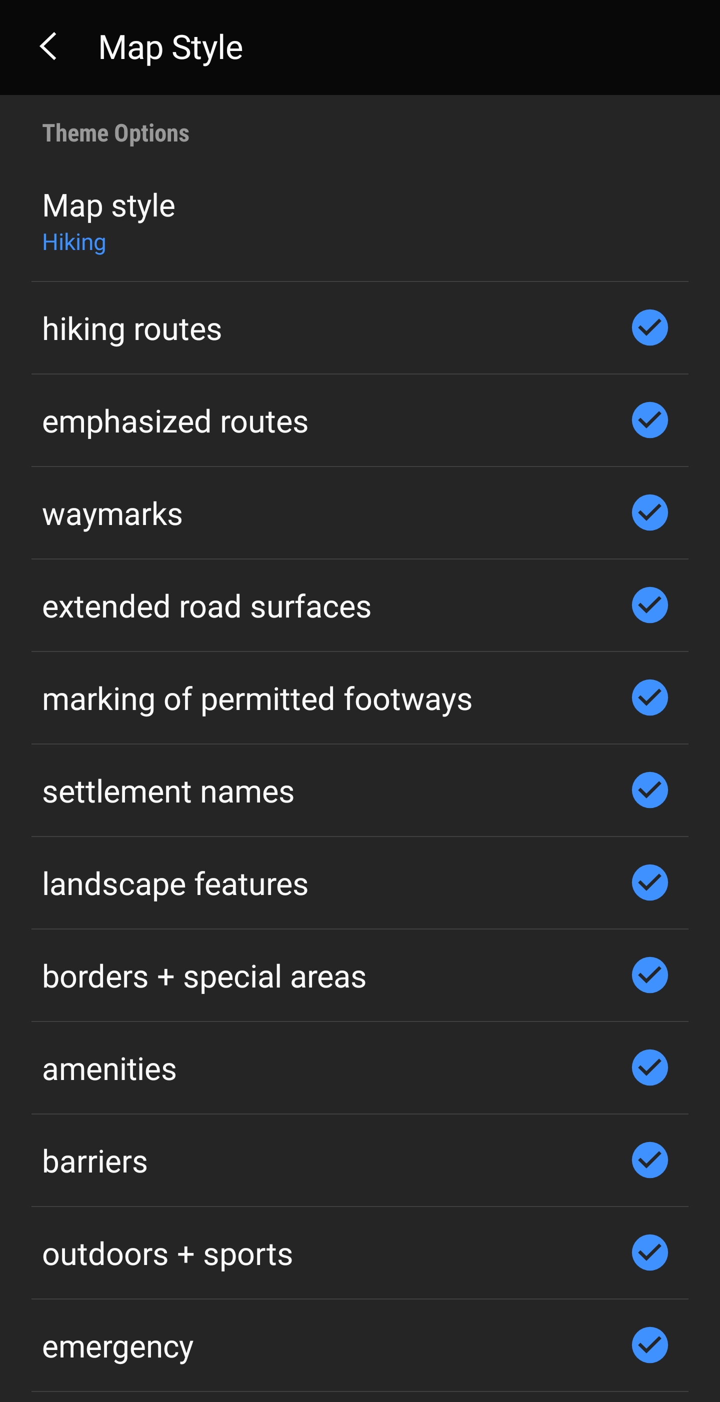
If you installed a theme, you can adjust and configure the visibility of certain map elements according to your need. You can find the related option in the (live) map menu under Theme Options.
Here you can select a basic map style (e.g. Hiking, Cycling, Car) and customize it afterwards by enabling/disabling additional elements of the map.
Link to some guides and tutorials made by c:geo users
| Link | Language | Description |
|---|---|---|
| Saarfuchs Blog | German | Tutorial about c:geo and offline usage |
